Map of Bradenton
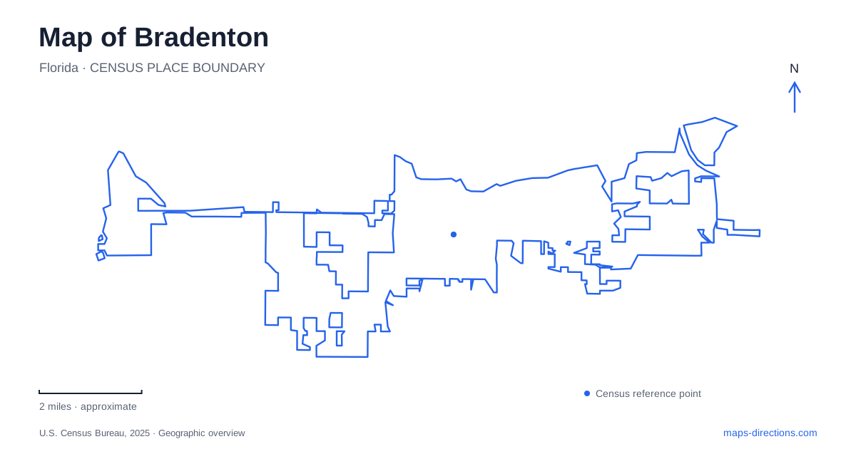
Street tiles load from OpenStreetMap when opened. The blue line shows the 2025 Census boundary.
- State
- Florida
- Population · July 2025
- 58,014
- Land area
- 14.3 sq mi
- Water area
- 3.2 sq mi
Bradenton's central geography follows the Manatee River, but its cultural destinations also extend into the numbered streets south of the waterfront. The Riverwalk introduces a public shoreline, the Bishop museum provides an indoor exploration of science and nature, and the Village of the Arts occupies a district of adapted historic homes. Farther west, the approach to De Soto National Memorial ends at a different part of the river landscape. Together, these places offer several ways to understand the city beyond a single downtown pin.
The Riverwalk gives downtown a water-facing edge
The city's parks directory identifies the Riverwalk along Barcarrota Boulevard, Waterfront Drive, and Riverside Drive. It developed through an expansion of Rossi Park and includes walking space, fishing, beach volleyball, a skate park, and areas used for entertainment and educational activities. The Green and DeSoto bridges provide large-scale reference points within the waterfront setting.
The combination makes the river edge more than a scenic promenade. Different stretches support different activities, so a walk can pass from a quieter view of the water to a sports or event space. The city's separate maps for western, central, eastern, and expanded sections are helpful for understanding that distribution.
On a downtown map, the Riverwalk supplies a clear horizontal reference along the water. Downtown streets lead toward it, while the bridges connect the local scene with movement across the river. A visitor can begin with a particular waterfront feature and then add nearby city blocks, rather than treating the entire riverfront as one undifferentiated park.
Old Main Street and a science museum
Old Main Street is a gathering place for the public market organized by Realize Bradenton. The market brings produce, art, and local food businesses into the street during its operating season. Its setting adds a different kind of public life to the nearby waterfront: temporary stalls and performances use an established commercial street rather than a purpose-built park lawn.
The Bishop Museum of Science and Nature is at 201 Tenth Street West. Its regional interpretation extends from the Pleistocene to the present, and its facilities include a planetarium and manatee rehabilitation habitat. The habitat's role is care and rehabilitation, so the presence of particular animals should not be assumed from an old photograph or visitor account.
The museum's address gives downtown Bradenton a substantial destination away from the outdoor path. An itinerary can therefore combine the river itself with scientific interpretation of the region, while retaining time for the indoor galleries and programs. The numbered street reference also makes the museum straightforward to locate in relation to the broader grid.
Historic houses become working art spaces
The Village of the Arts occupies an area from Ninth Avenue West to Seventeenth Avenue West, between Ninth and Fourteenth streets west. The city describes galleries, studios, and shops within vibrantly restored historic homes. That physical form distinguishes the district from a single art museum or a row of conventional retail units.
The street boundaries are especially useful because “village” here describes a district spread over several blocks. Its interest comes from moving among individual properties and seeing how domestic buildings have been adapted for artistic work and commerce. Porches, gardens, and house-scale frontages remain part of the experience.
This district gives Bradenton a second cultural geography south of the riverfront. The Riverwalk organizes movement along the shoreline, while the arts neighborhood invites movement through a grid of smaller streets. Both can be explored on foot within their respective areas, but each has its own rhythm: public waterfront recreation in one, dispersed studios and businesses in the other.
Seventy-fifth Street leads to De Soto Point
De Soto National Memorial is at 8300 De Soto Memorial Highway. The National Park Service directs visitors west along Manatee Avenue, then north on Seventy-fifth Street West, which becomes the memorial highway near its northern end. This road sequence places the memorial in a different part of the river landscape from the central Riverwalk.
The site interprets Hernando de Soto's 1539 expedition and the resistance of Indigenous peoples defending their homelands. That history concerns conquest, conflict, and the consequences of contact, giving the shoreline a meaning beyond its present-day appearance. The park's waterfront position helps connect the account to the coastal geography in which the expedition began.
For an extended Bradenton visit, the memorial can complement the downtown museum and arts district without being mistaken for another stop on the central promenade. Manatee Avenue and Seventy-fifth Street describe the overland approach; the river remains the natural reference linking the wider area. The contrast between urban riverfront, house-based art district, and memorial shoreline makes the city's map a guide to different uses of the same regional landscape.
Map and statistics: U.S. Census Bureau, 2025 Gazetteer, January 2025 generalized place boundaries and Vintage 2025 population estimates. Local references: City of Bradenton; Realize Bradenton; Bishop Museum of Science and Nature; Smithsonian; National Park Service. Article prepared by Maps & Directions.