Map of Bowling Green
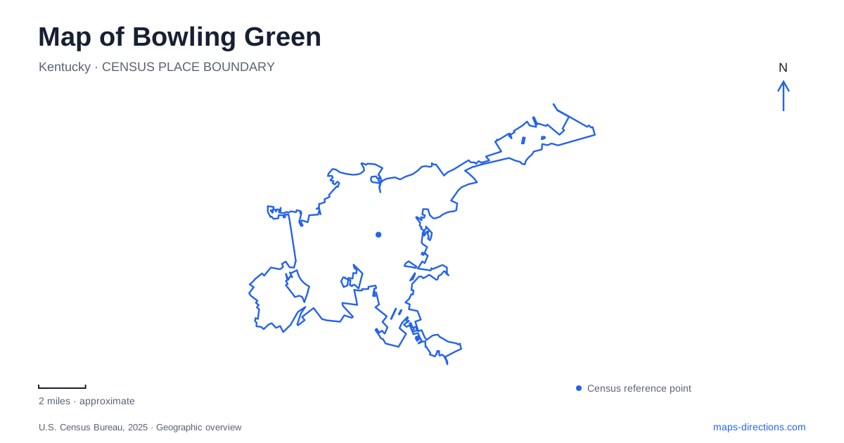
Street tiles load from OpenStreetMap when opened. The blue line shows the 2025 Census boundary.
- State
- Kentucky
- Population · July 2025
- 78,505
- Land area
- 42.0 sq mi
- Water area
- 0.3 sq mi
Bowling Green has several landscapes that reward reading together: the courthouse-era downtown, the railway corridor, the university campus, and the cave country beneath the developed surface. Automotive attractions add another major destination area near Interstate 65. A city map becomes more useful when those places are treated as a sequence of different settings, rather than a collection of unrelated attractions. The streets around Fountain Square provide a starting point, while the Barren River and the routes toward the university help extend the picture.
The square before and after the courthouse
Fountain Square Park occupies the old public center of Bowling Green. Robert Moore donated land for county buildings in 1797, and early courthouses stood here before the county shifted to another site. After the Civil War, a property exchange made it possible to convert the old square into a park. John Cox Underwood prepared the park plan in 1870, and water first flowed in its fountain in 1872.
The fountain now associated with the square is a later installation. The city acquired a cast-iron replacement from J. L. Mott Ironworks in 1881, topped by a figure of Hebe. That sequence matters when interpreting the park: its present appearance combines the former civic site, a nineteenth-century landscape project, and later improvements. The surrounding streets—East Main, Park Row, College, and State—frame a compact public space that can be read at walking scale.
The park's address is 445 East Main Street. It offers a useful central reference for the adjoining blocks without implying that every downtown destination lies directly on the square. The riverfront, depot, and university each introduce another part of the city's geography beyond this small landscaped center.
Kentucky Street and the railway landscape
The Historic RailPark and Train Museum at 401 Kentucky Street occupies the L&N Depot built in 1925. The operator places it within the long transportation corridor between Louisville and Nashville, where passenger rail helped connect the local economy to larger cities. The substantial depot makes that history visible in a way that a railway line alone cannot.
Behind the museum, restored equipment includes a railroad post-office car, the Duncan Hines dining car, the Towering Pine sleeper, a presidential office car, and a caboose. These show how a train once contained separate spaces for mail, meals, sleep, and railroad administration. For a visitor mapping Bowling Green, the depot is therefore both a destination and evidence of why this particular corridor mattered.
The Barren River provides a complementary transportation landscape. RiverWalk at Mitch McConnell Park, listed at 426 East Riverview Drive, includes the College Street pedestrian bridge and river overlooks. Its paths offer a different way of viewing the city's edges from the enclosed rooms of the depot or the streets around the square.
Reading the university by its own landmarks
Western Kentucky University requires a closer map than the downtown overview. Its campus directory distinguishes academic buildings, sports venues, parking structures, and public destinations such as the Kentucky Museum. The museum's current visitor address is 1472 Kentucky Street, in the Charles Hardcastle Kentucky Building. Older directions may show a different street number, so the museum's own current visitor information is the clearer reference.
The main campus map also identifies E. A. Diddle Arena, the football stadium, the Guthrie Bell Tower, and Hardin Planetarium. Those landmarks serve different purposes and occupy different parts of campus. Official campus tours begin at the Martens Alumni Center and Welcome Center, rather than automatically starting at the museum. This arrangement gives Bowling Green visitors several ways into university life, depending on whether the trip centers on exhibitions, athletics, astronomy, or a campus introduction.
A wooded valley with an underground river
Lost River Cave at 2818 Nashville Road adds a geological dimension that ordinary road maps cannot fully represent. Its urban park includes woodlands, prairie, wetlands, and the cave valley. The entrance and a 25-acre wooded valley were donated to WKU in 1986, helping establish the conservation effort that followed. Friends of the Lost River incorporated in 1990 to support preservation and stewardship.
The underground boat tour is only one part of that setting. Surface trails provide a way to see the surrounding habitats, while research associated with the university examines subjects including hydrology and karst terrain. The contrast between surface paths and underground water helps explain why this destination belongs to the region's cave landscape despite its urban address.
The automotive destination area
The National Corvette Museum stands at 350 Corvette Drive near I-65 Exit 28. NCM Motorsports Park uses a separate address, 505 Grimes Road. Keeping those two locations distinct is useful when a booking refers broadly to a Corvette experience: museum galleries and a driving facility call for different arrivals.
Together, the square, depot, campus, cave valley, and automotive sites reveal the range within Bowling Green. Their geography reflects changing forms of movement and work, from public roads and passenger trains to university research and automobile culture. A route built around those settings gives each stop a place in the city's larger story.
Map and statistics: U.S. Census Bureau, 2025 Gazetteer, January 2025 generalized place boundaries and Vintage 2025 population estimates. Local references: City of Bowling Green; Historic RailPark and Train Museum; Western Kentucky University; Lost River Cave; National Corvette Museum; NCM Motorsports Park. Article prepared by Maps & Directions.