Map of Bowie
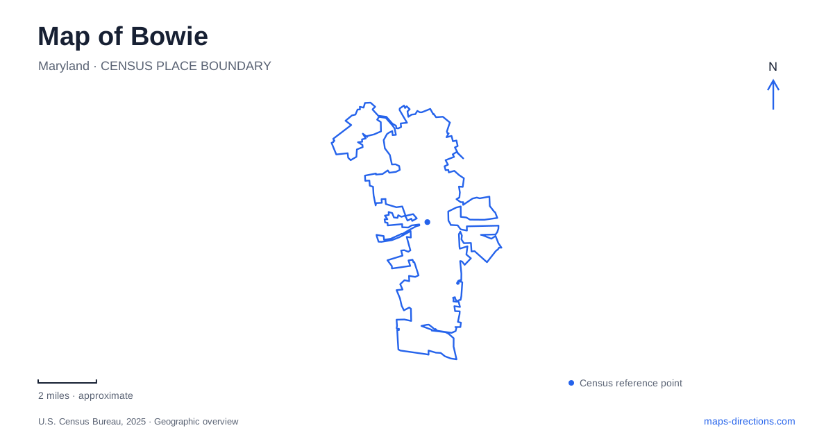
Street tiles load from OpenStreetMap when opened. The blue line shows the 2025 Census boundary.
- State
- Maryland
- Population · July 2025
- 58,383
- Land area
- 20.4 sq mi
- Water area
- 0.1 sq mi
Bowie grew from several landscapes rather than a single downtown expansion. A railroad junction generated one settlement, the Belair estate carried an older plantation and Thoroughbred history, and twentieth-century development transformed much of the surrounding area into neighborhoods. Today, museum properties and substantial parks preserve ways to see those layers. Chestnut Avenue, Tulip Grove Drive, Northview Drive, and White Marsh Park Drive provide four useful starting references.
Chestnut Avenue and the railroad village
The Bowie Railroad Museum is at 8614 Chestnut Avenue. The city's history dates the station's opening to 1872, when the Baltimore and Potomac Railroad created a transport connection around which developer Ben Plumb established Huntington City. Shops, houses, and other services followed the railway, explaining the compact village character associated with this part of town.
The station ceased passenger use in 1989 as service moved to a new station at the university. The city subsequently acquired and restored the old buildings. This distinction matters to the geographic story: the historic depot is now a museum setting, while the active passenger station belongs to a different location.
The museum campus includes the depot, tower, caboose, shed, and neighboring welcome-center building. Their arrangement makes the railway's role tangible. Instead of presenting local history solely through photographs inside a gallery, the site preserves a group of structures associated with the work of a station and the settlement that grew around it.
Belair links an estate to later neighborhoods
Belair Mansion stands at 12207 Tulip Grove Drive. Built for colonial governor Samuel Ogle around 1745, it occupied a high point within a much larger estate. The city's history describes a property that once included gardens, agricultural buildings, and a prominent Thoroughbred breeding operation.
The Woodward family revived the estate in the late nineteenth and early twentieth centuries, adding the stable building that is now a museum. Gallant Fox and Omaha, the father-and-son Triple Crown winners of 1930 and 1935, connect Belair with a specific chapter of racing history. The mansion and stable consequently interpret different aspects of the same estate: domestic and political life on one hand, horse breeding on the other.
In 1957, William Levitt purchased the property and used the mansion as an office while developing the surrounding area. The house later served as City Hall before becoming a museum. This sequence explains a major part of modern Bowie's landscape: a historic estate building survives amid a much later suburban pattern, carrying evidence of several successive uses.
Allen Pond concentrates community recreation
Allen Pond Park is at 3330 Northview Drive. The city describes an eighty-five-acre recreation area centered partly on a ten-acre pond, with an ice arena, skate park, and Robert V. Setera Amphitheater among its facilities. Opportunity Park adds accessible play experiences for preschool and school-age children.
The combination gives the park several different rhythms. A walk beside the pond is distinct from attending an arena activity or an amphitheater event, even though all take place within the same larger grounds. Fields, picnic areas, and improved walking and cycling routes create additional uses around the water.
Northview Drive is the practical street anchor for this cluster. At map scale, the pond provides an easily recognizable shape, while the arena and amphitheater identify specific destinations around it. This is a designed community recreation landscape, contrasting with both the small railroad museum campus and the surviving estate buildings at Belair.
Whitemarsh follows a stream and wooded routes
Whitemarsh Park is reached at 100 White Marsh Park Drive. Its grounds include the Bowie Playhouse, ballfields, picnic space, a playground, and both improved and unimproved trails. The park map identifies Whitemarsh Branch as a natural organizing feature within a much larger wooded recreation area.
Named routes include Discovery Nature, Tulip Loop, Vistas, and Lower Vistas. Their mapped surfaces and terrain differ, with unpaved walking options branching from the longer paved park route. The city's trail information also identifies connections toward Forest Drive and Spur Way, showing how the park meets the surrounding neighborhoods.
Whitemarsh adds a further dimension to Bowie beyond historic buildings and the pond-centered park. A theater visit, a field activity, and a woodland walk can each begin within the same grounds but lead to different parts of the site. Reading the stream, trails, and built facilities together explains that variety. Across the city, the railroad village, Belair estate, Allen Pond, and Whitemarsh remain distinct places whose histories and physical forms reward separate attention.
Map and statistics: U.S. Census Bureau, 2025 Gazetteer, January 2025 generalized place boundaries and Vintage 2025 population estimates. Local references: City of Bowie. Article prepared by Maps & Directions.