Map of Bountiful
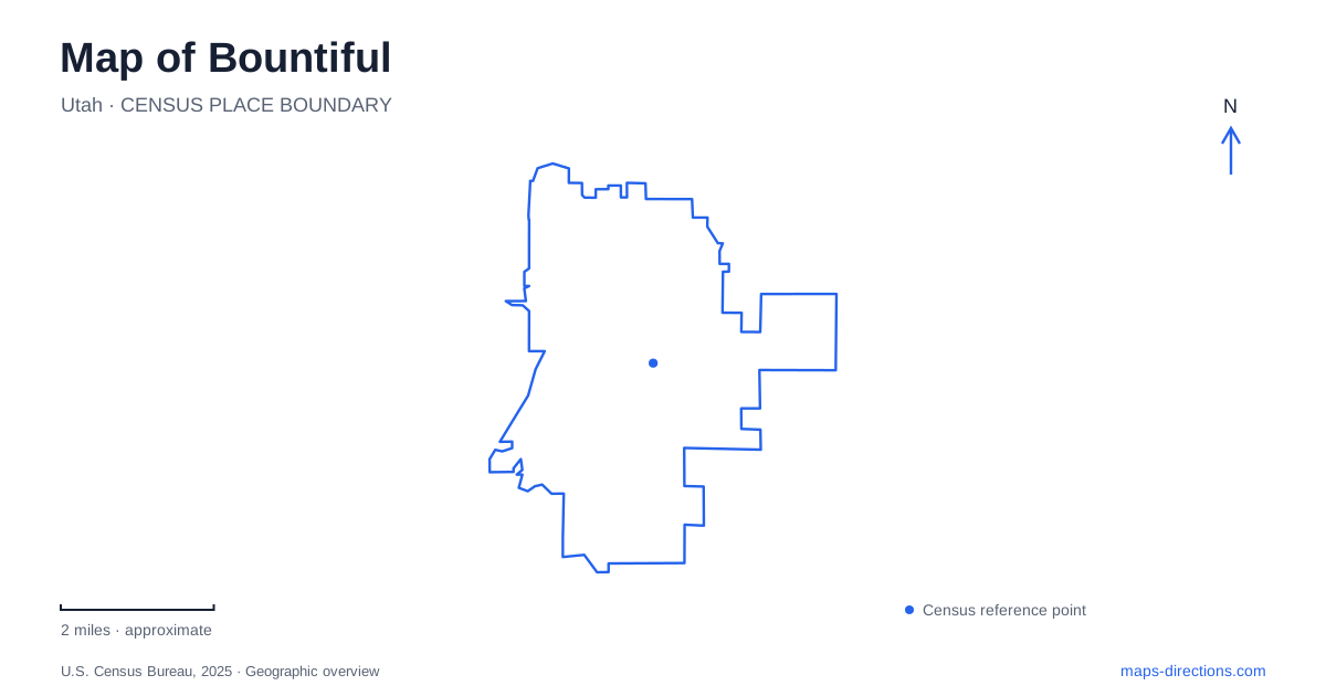
Street tiles load from OpenStreetMap when opened. The blue line shows the 2025 Census boundary.
- State
- Utah
- Population · July 2025
- 44,988
- Land area
- 13.2 sq mi
- Water area
- 0.0 sq mi
Bountiful offers a clear contrast between its numbered downtown streets and the canyon landscape reached toward the mountains. Main Street, Town Square, and the historic tabernacle belong to the lower urban setting. Mueller Park and Holbrook Canyon introduce streams, slopes, and routes that cannot be understood as extensions of a regular street grid. A map becomes more informative when these two settings are read together: the older settlement supplied the civic center, while the foothills remain a strong influence on local geography and recreation.
The early town had a defined enclosure
The city's historical account places Peregrine Sessions' 1847 winter shelter near today's 250 North and 280 West. The settlement grew as more families arrived, and it acquired its present name in 1855. The same account describes an earthen wall built around the townsite that year, broadly enclosing an area between 400 North, 200 West, 500 South, and 400 East.
Those modern street references help locate an earlier phase of Bountiful without implying that the wall still survives. They outline the scale of the settlement within a much larger contemporary city. The numbered roads also make the historical description unusually easy to compare with a present-day map. Instead of relying on an approximate dot for an early village, a reader can examine the blocks that formed its organized core and see how later development extended beyond them.
A nineteenth-century gathering place on Main
The historic tabernacle's construction began in 1857 and was completed in 1863. Designed by Augustus Farnham, the building uses Greek Revival architecture and appears on the National Register of Historic Places. The city's account connects its construction with materials from the surrounding landscape, including timber from Holbrook Canyon.
The building consequently relates two parts of the map: a downtown gathering place and the mountain resources used to construct it. Its long survival gives Main Street a tangible reference to the nineteenth-century community. For Bountiful, that connection is more revealing than treating the tabernacle solely as an architectural photograph. The structure reflects the labor and materials required to create a substantial public religious building within the young settlement.
The tabernacle should also be distinguished from the later temple on the eastern hillside. The temple's address is 640 South on the boulevard bearing the city's name, and its dedication dates to 1995. They represent different buildings, purposes, and periods of religious development.
Town Square and public art
Town Square is at 75 East 200 South. Its water feature operates seasonally, providing a different kind of gathering space from the historic religious and commercial buildings nearby. The city's public art program places works along Main Street and in the square, linking the street corridor with the newer civic space.
This creates a useful downtown focus for a Bountiful walk. The square supplies an outdoor destination, while the art program encourages attention along the connecting streets. The city's viewing guide can help identify individual works rather than reducing the area to one park symbol. Because the water feature depends on season and operating conditions, the square's location and its available activities should be considered separately. An outdoor gathering place remains part of the downtown setting even when one particular feature is not running.
Mueller Park opens into canyon terrain
The Mueller Park trail begins by picnic grounds and leads into national forest terrain. Elephant Rock is a recognized destination along the route, with viewpoints toward the foothills, Great Salt Lake, and Antelope Island. The state tourism guide describes a seven-mile out-and-back journey to this area, rather than a short paved neighborhood loop.
Near Elephant Rock, the route branches: one direction leads toward the overlook, while the other continues toward Rudy's Flat and North Canyon. That junction shows why a canyon trail should be read as a network with distinct destinations. Continuing onward changes the outing rather than merely adding another block to a city walk. The route is shared with other trail users, and its dirt and rock surface belongs to a mountain environment with seasonal changes.
Holbrook Canyon connects history and present access
Holbrook Canyon supplies another mountain reference in Bountiful, including the historical association with timber used downtown. Its trail has its own access conditions. Consult the city's Holbrook Canyon trail guidance for maintenance restrictions and rockfall hazards before selecting a route into the canyon.
That notice is a reminder to treat a canyon route as a managed recreation site, not simply an open line on a map. Main Street's historic buildings, the square's public art, and the foothill trails can all contribute to understanding the city, but they ask for different amounts of preparation. Choose the urban or mountain portion of the visit deliberately, then use the appropriate site information to make that particular outing workable.
Map and statistics: U.S. Census Bureau, 2025 Gazetteer, January 2025 generalized place boundaries and Vintage 2025 population estimates. Local references: City of Bountiful; Church of Jesus Christ of Latter-day Saints; Utah Office of Tourism. Article prepared by Maps & Directions.