Map of Boulder
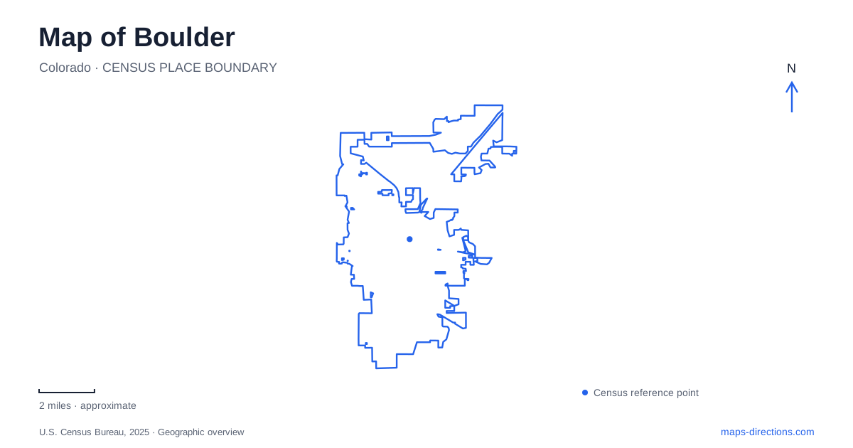
Street tiles load from OpenStreetMap when opened. The blue line shows the 2025 Census boundary.
- State
- Colorado
- Population · July 2025
- 105,689
- Land area
- 26.9 sq mi
- Water area
- 1.1 sq mi
Boulder is especially readable where its downtown street grid meets the creek and foothills. Pearl Street provides an urban sequence of numbered cross streets, while the water corridor offers a separate east–west line through parks. At the western edge, trailheads introduce rock formations and climbing terrain. Farther south, Chautauqua brings together a historic cultural campus and routes toward the Flatirons. These places are close enough to belong in one city overview, but their layouts tell different stories about movement, public space, and the landscape.
Four pedestrian blocks on Pearl
The Pearl Street Mall occupies the four blocks between 11th and 15th streets. Its original construction was completed in 1977, and the city recognizes the significance of its landscape design. The numbered endpoints give a much more precise picture than the broad phrase downtown: Pearl continues beyond the mall, while the pedestrian environment has defined limits.
Even within those limits, the crossing streets matter. The municipal description excludes the roadway areas at Broadway, 13th, and 14th from the mall itself. Walking along the brick-paved blocks therefore involves recognizable street crossings rather than an uninterrupted enclosed shopping precinct.
This is a distinctive part of Boulder's public-space geography. The mall functions as an outdoor urban place within an existing street network. Reading the blocks individually helps explain the alternating rhythm of storefronts, planted areas, and cross streets. It also leaves room for the wider downtown beyond 11th and 15th, rather than treating the pedestrian mall as the entire central district.
The creek offers another way across town
Boulder Creek establishes a different orientation south of Pearl. At 101 Arapahoe Avenue, Eben G. Fine Park combines creek access, a playground, open turf, and a historic stone picnic shelter. The park includes part of the multiuse path that follows the water, making it a place where recreation and through-movement overlap.
A pedestrian and bicycle bridge connects this park to The Peoples' Crossing and the Red Rocks trail area directly north. That connection is a useful piece of local geography: the two sites occupy different sides of the creek, but a specific bridge links them. The park's address on Arapahoe and the trailhead's address on Pearl describe the street approaches to this connected outdoor area.
The city's creekside civic-park project farther east uses 9th Street, Canyon Boulevard, 14th Street, and Arapahoe Avenue as its boundaries. Those four edges define a central area below the Pearl Street blocks. Together, the civic park and the western creek park show how downtown's public spaces are distributed along both streets and water, rather than concentrated in one square.
A crossroads at the west end of Pearl
The Peoples' Crossing is at 101 Pearl Street, where the western end of Pearl meets Canyon Boulevard. It provides access to the Red Rocks trail network. The site was formerly called Settler's Park; its newer name was developed by representatives of federally recognized American Indian Tribes through the city's Indigenous Peoples Day work.
That name adds important historical depth to a Boulder map. It recognizes a crossroads used by Indigenous Peoples long before the modern street grid. The trailhead is consequently both a recreation access point and a place whose naming expresses a broader understanding of local history.
The paved connection from the creek should not be confused with permission to cycle on every adjoining trail. The city prohibits bicycles on the Red Rocks area trails. Here the transition from a multiuse urban path to a foothill trail system is visible in both the terrain and the permitted uses.
Baseline Road and the Chautauqua landscape
Chautauqua's trailhead is at 900 Baseline Road, near Grant Place. The Ranger Cottage supplies maps and information, and trails lead from this area toward the Flatirons. The lawn, auditorium, dining facilities, and cottages add a cultural landscape alongside the hiking routes.
The institution opened in 1898, when local civic leaders and Texas educators created a summer educational retreat. Permanent cottages began replacing the first season's tents in 1899. That sequence explains why the grounds contain a group of small buildings instead of a single large cultural center: the campus grew from a seasonal gathering into a lasting community of lodging and public spaces.
King's Gate on Baseline Road preserves another transportation story. It served as an arrival point for the historic trolley from downtown, with stone entry pillars added in 1900. For Boulder visitors today, the gate, cottages, lawn, and trailhead show how cultural travel and mountain recreation developed together. They also provide several concrete landmarks along the city's southern foothill edge, complementing Pearl's numbered blocks and the creek's east–west corridor.
Map and statistics: U.S. Census Bureau, 2025 Gazetteer, January 2025 generalized place boundaries and Vintage 2025 population estimates. Local references: City of Boulder; City of Boulder Municipal Code; Colorado Chautauqua Association. Article prepared by Maps & Directions.