Map of Bonita Springs
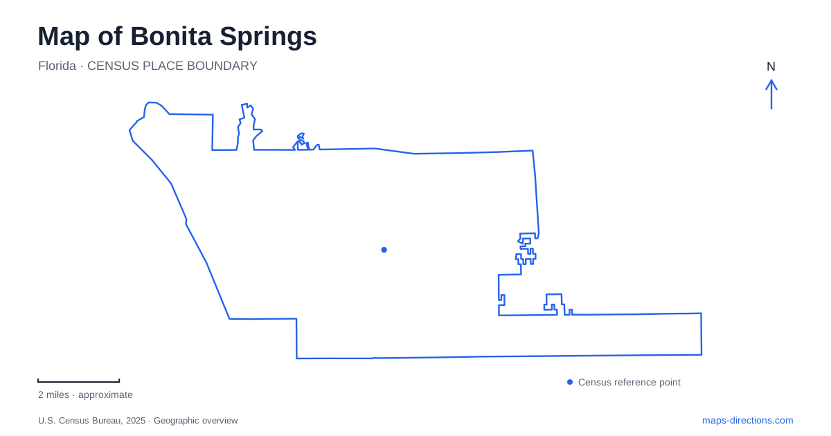
Street tiles load from OpenStreetMap when opened. The blue line shows the 2025 Census boundary.
- State
- Florida
- Population · July 2025
- 57,634
- Land area
- 38.4 sq mi
- Water area
- 8.1 sq mi
Bonita Springs has a river town at its center and a beach landscape farther toward the coast. Old 41 and the Imperial River identify the historic downtown, while Hickory Boulevard serves the beach area. Inland, Kent Road leads toward nature properties where the same river belongs to a quieter setting of woodland and wildlife habitat. These are three different ways to experience the community, and the river provides the strongest connection between them: it carries water from the inland watershed toward the estuarine environment of Estero Bay.
Old 41 and the riverfront gathering places
Riverside Park occupies a prominent downtown position off Old 41 beside the Imperial River. The historic Liles Hotel, artist cottages and bandshell give the grounds a mixture of cultural and recreational uses. The hotel dates to 1926, while the cottages recall the area's fishing bungalow tradition. Their presence makes the riverfront more than an open lawn; it is also a collection of buildings through which the older community remains visible.
The historic core of Bonita Springs is particularly well suited to being understood through these small landmarks. A hotel, cottages, a butterfly garden and a veterans memorial occupy a more intimate scale than the broad coastal road system. Identifying them individually helps explain why a downtown visit can be about local history and art even when the beach is the better-known regional attraction.
Downtown improvement plans distinguish the park grounds, Liles Hotel Plaza, adjoining green space and Banyan Lot. Those names help identify separate public spaces even when they appear together in a redevelopment illustration. A gathering at the plaza and recreation inside the park may use different entrances. Check the city's facility descriptions for the specific space involved, rather than treating every feature shown in a project drawing as an available amenity.
The Imperial River in an inland setting
Bonita Nature Place introduces a different Bonita Springs landscape at 27601 Kent Road. The property lies along the Imperial River and combines oak hammocks, pine flatwoods, riverine forest and aquatic habitat. Instead of organizing a visit around a broad waterfront view, the site encourages attention to the smaller transitions between trees, dry ground and water.
Gopher tortoises live on the property, and the city prohibits dogs there because of the wildlife. Butterfly gardens, a bee observation feature and a bat house add educational subjects that can be explored without treating the grounds as a conventional playground. The plants and animals are part of the reason to visit, and the habitat is the main organizing feature of the site.
The river here drains freshwater associated with the Corkscrew Regional Watershed toward Estero Bay. That relationship gives the inland reserve a connection to the coastal environment even though the two look very different. The river is not merely a scenic line through downtown; it is part of a larger drainage system linking several habitats.
Pine Lake Preserve and the Kent Road approaches
Pine Lake Preserve adjoins the Nature Place and provides another outdoor option in Bonita Springs. Lee County identifies pedestrian access from a gate southeast of the YMCA parking entrance and from the shared boundary with the city nature property. The YMCA address is 27200 Kent Road, placing both approaches on the same named road but at different points along it.
The county's map describes a network of firebreaks available for walking rather than a system of formally designated hiking trails. Their surfaces can be sandy, uneven or flooded after substantial rain. This distinction has a practical effect on the outing: walking a managed firebreak is a different experience from following a surfaced park path, especially for people with mobility concerns or families bringing wheeled equipment.
The nearby Cullum's trail and kayak launch adds access to the upper river. The cluster of properties along Kent Road therefore offers several scales of exploration, from environmental learning to a longer walk or a paddle. Their proximity is useful, but each has its own purpose and access arrangement.
Hickory Boulevard and the coast
Bonita Beach Park is on the southern tip of Bonita Beach, along Hickory Boulevard. Lee County also manages numbered beach access points farther along the coastal corridor. Barefoot Beach Preserve, although reached from the same general Bonita Beach Road area, belongs to Collier County. Similar beach names can consequently refer to different public facilities and different managing agencies.
For a Bonita Springs beach visit, distinguish the beach park's parking and amenities from nearby Access Number 1. They provide separate references along the coast, and storm damage or restoration can affect them differently. An access limitation at one site does not establish the condition of every beach in the area. Planning around the chosen access point, rather than a general coastal label, connects the inland road journey to the intended part of the shoreline.
Map and statistics: U.S. Census Bureau, 2025 Gazetteer, January 2025 generalized place boundaries and Vintage 2025 population estimates. Local references: City of Bonita Springs; City of Bonita Springs Recreation; Lee County Parks and Recreation; Lee County; Collier County Parks. Article prepared by Maps & Directions.