Map of Blue Springs
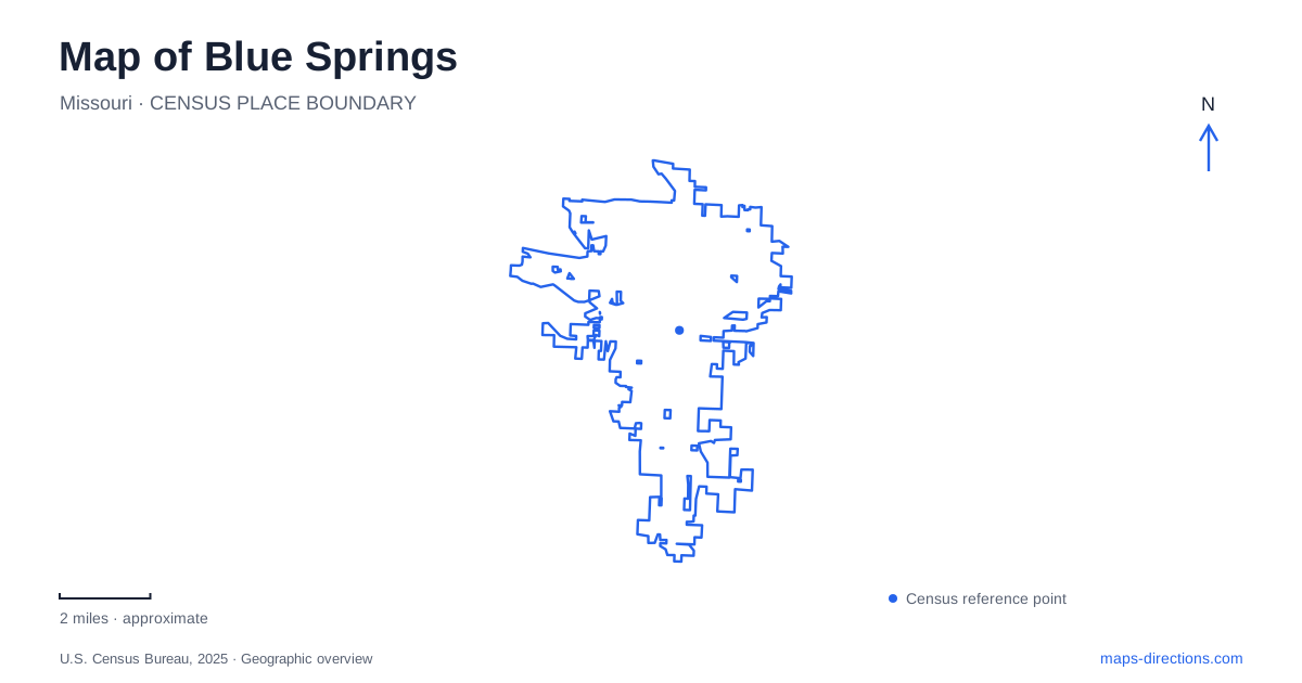
Street tiles load from OpenStreetMap when opened. The blue line shows the 2025 Census boundary.
- State
- Missouri
- Population · July 2025
- 61,632
- Land area
- 22.2 sq mi
- Water area
- 0.1 sq mi
Blue Springs combines an interstate-oriented street network with woodland ravines, neighborhood lake parks and the larger recreation landscape of Fleming Park. Interstate 70 and Highway 7 are useful first references, but they do not explain every part of the city equally well. North of the interstate, Burr Oak Woods introduces forested slopes and exposed limestone. Adams Dairy Parkway organizes another set of paths and park connections, while the county's lakes form a separate destination cluster. The contrast among these settings is the most useful starting point for reading the map.
Highway 7 connects the interstate with Burr Oak Woods
The Missouri Department of Conservation places Burr Oak Woods just north of I-70 and describes an approach from Highway 7 west along Park Road. This gives the conservation area a clear position in relation to the regional road network. A visitor can understand the turn from a major highway corridor toward a more enclosed woodland landscape without treating the whole north side as one recreation area.
Within Blue Springs, Burr Oak Woods is distinctive for its steep forested hillsides along Burr Oak Creek, limestone boulders and outcrops, and restored prairie and woodland. Those features explain why the trail map contains varied routes rather than one simple circuit around a flat park. The creek and rock formations shape the experience of moving through the property and provide a different geographic vocabulary from the surrounding streets.
The conservation trails reveal several habitats
The department's trail brochure distinguishes the Missouri Tree Trail near forest edge and prairie plantings from the Discovery Trail through mature woodland behind the nature center. Bethany Falls Trail passes limestone outcrops, while other routes reach more outlying areas. These names describe particular landscapes and connections within the conservation area, not merely different distances on an otherwise identical route.
That variety makes the nature center a useful orientation point. From it, a visitor can compare a short interpretive outing with a route designed around rock formations or broader habitat changes. The park's map explains how woodland, prairie restoration and creek slopes fit together. It also makes clear that the conservation area is a substantial landscape with internal structure, rather than just a green buffer beside the interstate.
Pink Hill adds an adjacent sports setting
Pink Hill Park is listed by the city at 2715 Northwest Park Drive, between the conservation area and James Lewis Elementary School. Its facilities include sports fields, playgrounds, shelters, a BMX course and Veterans Way Memorial. This creates a useful contrast on a Blue Springs map: a municipal park designed for organized activities lies near a conservation landscape managed for nature interpretation and habitat.
The neighboring names should not obscure their different purposes. A tournament, a memorial visit and a woodland hike occupy the same broad part of town but belong to different facilities. Park Drive supplies the municipal-park address, while the conservation department's Highway 7 and Park Road approach explains the woodland destination. Their proximity is geographic context, not evidence that one entrance serves every activity.
Adams Dairy Parkway links paths with a lake park
The city identifies a bicycle and walking route along Adams Dairy Parkway between Roanoke and Wyatt Road. Its trail information also describes a path around the lake at Gregory O. Grounds Park, with access from Duncan Road and Jefferson Street parking areas and a connection to the parkway. This is a more urban recreational pattern than the Burr Oak trails: a linear street corridor links with a park-centered loop.
In Blue Springs, the parkway and Grounds Park can therefore be read together as a network with different route choices. The city calls the water body Remembrance Lake in its parks directory. That specific name helps distinguish this local setting from the much larger county lake destination. It is a neighborhood-scale water feature connected to municipal paths, not the same place as a marina or campground in Fleming Park.
Fleming Park contains two major lakes
Jackson County describes Fleming Park as containing Lake Jacomo and Blue Springs Lake, with marinas, boat ramps, campgrounds and other recreation facilities. Woods Chapel Road is a useful regional approach reference. The two lakes share a park system while retaining separate shorelines and facility maps, so the park name alone is broader than most individual visits.
Reading the city through these contrasting landscapes produces a coherent overview: interstate and Highway 7 for regional arrival, creek slopes and limestone at Burr Oak Woods, sports facilities at Pink Hill, municipal trail connections along Adams Dairy Parkway, and the county lake complex around Woods Chapel Road. Each adds a different piece of geographic information, making the area more understandable than a map focused only on highway exits.
Map and statistics: U.S. Census Bureau, 2025 Gazetteer, January 2025 generalized place boundaries and Vintage 2025 population estimates. Local references: Missouri Department of Conservation; City of Blue Springs; Jackson County Parks and Recreation. Article prepared by Maps & Directions.