Map of Biloxi
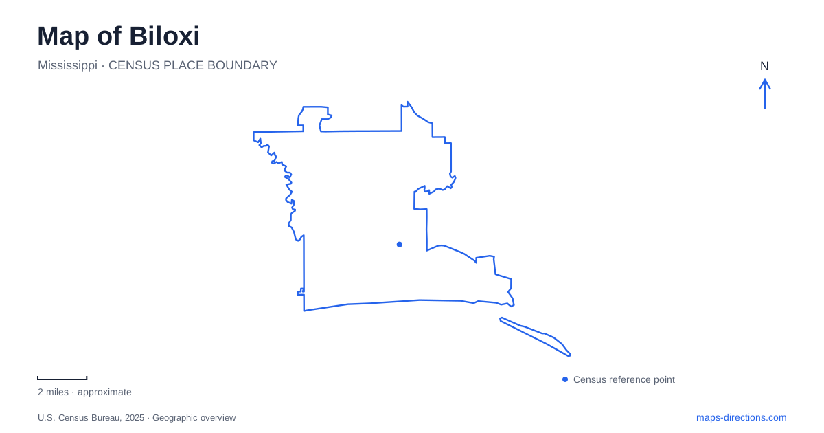
Street tiles load from OpenStreetMap when opened. The blue line shows the 2025 Census boundary.
- State
- Mississippi
- Population · July 2025
- 48,516
- Land area
- 42.9 sq mi
- Water area
- 24.8 sq mi
Biloxi’s coastal map is shaped by more than beaches and large resorts. Beach Boulevard links a lighthouse, a visitor center, an art-museum campus, and maritime destinations, while the peninsula’s eastern end preserves a strong connection with the seafood industry. The coast also contains buildings that have been restored, relocated, or reconstructed after storms. Knowing which kind of place a marker represents makes the city’s history easier to read.
A lighthouse in the highway median
The lighthouse at Porter Avenue stands in the median of U.S. 90. Completed in 1848, its cast-iron exterior encloses a brick lining. The unusual relationship between tower and roadway makes it a striking orientation point, but it also means that seeing the landmark from the surrounding streets is different from entering it.
The light’s history includes several women keepers, notably Maria Younghans, whose service lasted more than half a century. Federal operation eventually gave way to municipal ownership in 1968. Storm damage and restoration are also part of its story, including major work after Hurricane Katrina.
Lighthouse climbs require their own visitor arrangements, distinct from viewing the tower from the surrounding streets. A map pin therefore identifies an enduring landmark without promising present interior access. This distinction is especially relevant when older travel descriptions still advertise regular climbs.
A new building with an architectural memory
The visitor center at 1050 Beach Boulevard opened in 2011 north of the lighthouse. Its porches, staircase, and tall windows draw inspiration from the Dantzler House, which formerly stood on the site and was destroyed by Katrina in 2005. The center is a later building recalling that architectural heritage, not the original house restored intact.
Inside, multimedia exhibits interpret the city’s people, water connections, and cultural diversity. The upper porch provides a different perspective on the beach and Mississippi Sound. For Biloxi visitors, this combination makes the center an orientation point in both senses: it helps locate attractions and provides context for the coastal landscape outside.
Art distributed across a campus
The Ohr-O’Keefe Museum of Art occupies 386 Beach Boulevard. Its campus, designed by Frank Gehry, contains several separate buildings and outdoor circulation spaces rather than one conventional block of galleries. The museum’s development proceeded in stages, including the first phase opening in 2010 and the ceramics center in 2012.
The institution preserves the legacy of potter George Ohr while also interpreting wider Gulf Coast culture. Its arrangement encourages visitors to understand the buildings, grounds, and exhibitions together. A campus-wide map is more useful here than assuming every gallery or studio lies behind one entrance.
The Pleasant Reed Interpretive Center within the grounds adds an important distinction. The original family house was moved from Elmer Street to the museum site in 2002, then destroyed by Katrina in 2005. The present structure reconstructs its exterior from the original plans, with an interior adapted for interpretation. It tells the story of a Black family’s life and perseverance under segregation, while its own rebuilding history explains why it should not be described as an untouched nineteenth-century home.
Maritime exhibits and a different sailing address
The Maritime & Seafood Industry Museum stands at 115 First Street near the peninsula’s eastern end. Its focus connects the city’s waterfront with fishing, boat work, processing, and the people whose livelihoods depended on the sea. The museum also houses the Hurricane Camille Memorial, commemorating those who died in the devastating 1969 storm.
Its schooners operate from a separate pier complex at 367 Beach Boulevard. The Glenn L. Swetman and Mike Sekul are replicas of the oyster schooners associated with the coast’s earlier seafood industry. A sailing booking and a museum visit therefore require different destination addresses, even though the same institution organizes both experiences.
This relationship is particularly useful on a Biloxi map. The museum explains maritime work through interpretation and collections, while the replica vessels offer an experience on the water. Neither should be confused with a general beach access point or a commercial fishing dock.
Regional travel returns to the coast
Amtrak’s Mardi Gras Service began in August 2025, reconnecting the coastal corridor between New Orleans and Mobile with intermediate Mississippi stops. That return is part of the corridor's transportation history; check Amtrak's timetable and station information for the journey you intend to make.
For Biloxi, the rail connection adds another way to understand regional movement alongside the beachfront highway. It does not eliminate the need to distinguish individual local destinations: the lighthouse, art campus, maritime museum, and schooner pier still occupy separate places.
The strongest local reading of the coast keeps those differences visible. A map of Biloxi records working-water history, artistic experimentation, migration and family life, storm loss, and reconstruction within a relatively connected shoreline setting. Understanding what survived, what moved, and what was rebuilt gives each stop more meaning than its location alone.
Map and statistics: U.S. Census Bureau, 2025 Gazetteer, January 2025 generalized place boundaries and Vintage 2025 population estimates. Local references: City of Biloxi; Ohr-Okeefe Museum of Art; Museum operator; Maritime and Seafood Industry Museum; Amtrak. Article prepared by Maps & Directions.