Map of Bettendorf
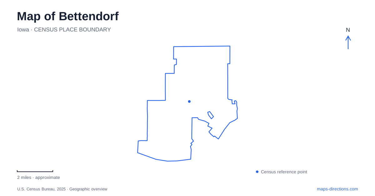
Street tiles load from OpenStreetMap when opened. The blue line shows the 2025 Census boundary.
- State
- Iowa
- Population · July 2025
- 40,710
- Land area
- 21.3 sq mi
- Water area
- 1.1 sq mi
Bettendorf is shaped by two kinds of water corridor: the broad Mississippi riverfront and the smaller Duck Creek valley running through the Iowa side of the Quad Cities. The first supports interstate crossings, waterfront recreation, and the city's industrial history. The second links neighborhoods and parks farther inland. A useful map keeps both in view, because the riverfront trail and creek-side parkway explain different ways of moving through the community.
An industrial waterfront with a residential history
The settlement formerly known as Gilbert took its present name in 1903 when an axle manufacturer established operations there. The company became a major supplier of railroad-car underframes, and its workshops eventually stretched along a substantial section of the Mississippi shore. This industrial foundation helps explain the close relationship among the river, railway tracks, and State Street.
The University of Iowa's migration-history project documents Holy City, a predominantly Mexican neighborhood on company-owned land between the river and tracks along State Street. Residents worked in the foundries and lived in a mixture of converted boxcars, cottages, and other housing. Historical accounts distinguish a Boxcar Section near 26th Street from a Cottage Addition around 30th and 31st streets.
Holy City was later cleared, so it should be understood as a historical neighborhood rather than a surviving district of original homes. Including its geography on a map of Bettendorf restores a residential dimension to the industrial waterfront. The shoreline was a place of family life and community formation as well as manufacturing and transportation.
A crossing for walking and cycling
The new I-74 bridge connects the Iowa shore with Moline, Illinois. It opened fully to motor traffic in December 2021, followed by completion of its bicycle and pedestrian path in April 2022. The path is physically separated from highway traffic and connects with trails on both sides of the Mississippi.
The opening announcement identifies access from Grant Street, also US 67, on the Iowa side and River Drive on the Illinois side. Its 14-foot width accommodates travel in both directions. An overlook includes a ten-foot glass oculus, allowing a view down toward the river through a textured glass surface.
This crossing changes how the Bettendorf riverfront can be experienced. The bridge is both a regional highway and a direct walking or cycling connection between two downtown waterfronts. On a route map, the bicycle and pedestrian path should be read as its own connection, with shore-side access points, rather than as permission to use the interstate roadway.
Leach Park at the water's edge
Leach Park occupies the downtown riverfront at 100 12th Street. The regional tourism office identifies picnic shelters, covered tables, benches, and swings along the Riverfront Trail. It offers a place to pause beside the water while remaining connected to the larger shoreline route.
Its position at the foot of a numbered street makes it a useful local landmark when relating downtown blocks to the Mississippi. The park's purpose differs from the bridge overlook: one provides an elevated view across the crossing, while the other keeps visitors at the river's edge. Combining the two gives a fuller sense of the scale of the waterway and the structures spanning it.
Duck Creek's inland parkway
Duck Creek Parkway follows the smaller stream through Davenport and Bettendorf toward Riverdale. The paved corridor connects parks, residential neighborhoods, and other trails. Devils Glen Park and Veterans Memorial Park provide access on this side of the regional network, while a succession of parks continues west through Davenport.
Published trail lengths vary with the section or network being measured. The city's 2024 parks plan identifies a local segment of 5.95 miles, while regional descriptions include a longer route across municipal boundaries. The geographic distinction is more useful than choosing one mileage for every outing: a short local section and the full cross-city corridor are different journeys.
The inland water features also include several small fishing destinations. Iowa's Department of Natural Resources locates Middle Park Lagoon at the end of Parkway Drive, Hopewell Pond at Middle Road and Hopewell Avenue, and Crow Creek Pond behind the baseball complex on Crow Creek Park Road. These are separate park waters, not alternate names for Duck Creek or riverfront fishing areas.
Together, the industrial shoreline, Leach Park, the I-74 path, and the inland creek corridor give Bettendorf a connected but varied geography. Following the Mississippi reveals its regional role, while tracing Duck Creek and the smaller park ponds brings the surrounding neighborhoods into focus.
Map and statistics: U.S. Census Bureau, 2025 Gazetteer, January 2025 generalized place boundaries and Vintage 2025 population estimates. Local references: University of Iowa Libraries; Visit Quad Cities / Iowa and Illinois DOT; Visit Quad Cities; QC Trails; City of Bettendorf; Iowa Department of Natural Resources. Article prepared by Maps & Directions.