Map of Bellevue
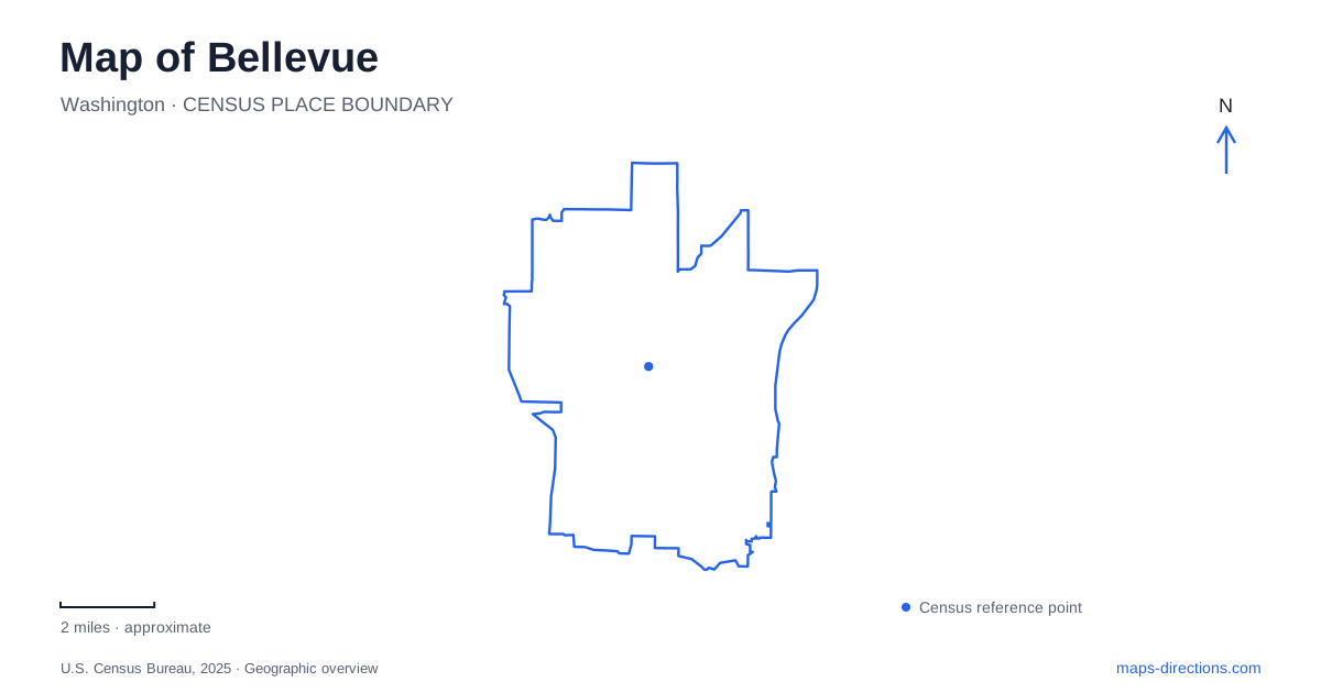
Street tiles load from OpenStreetMap when opened. The blue line shows the 2025 Census boundary.
- State
- Washington
- Population · July 2025
- 154,193
- Land area
- 33.5 sq mi
- Water area
- 4.0 sq mi
Bellevue combines an intensely developed business center with waterfront parks, freshwater wetlands and surviving agricultural fields. These landscapes have different origins and occupy different positions in the city. Meydenbauer Bay connects the older commercial district with Lake Washington; Downtown Park creates a formal green space within the urban core; Mercer Slough preserves a much larger wetland environment to the south. Understanding those relationships helps explain why a short movement across a map can lead into a completely different kind of place.
From Main Street toward the bay
The western portion of Main Street is the older commercial area commonly called Old Bellevue. Its relationship with Meydenbauer Bay is central to understanding the original settlement. The waterfront once supported working boats as well as recreation, and the bay's historic Whaling Building preserves a tangible connection to that maritime economy.
The expanded waterfront park opened in 2019 with a larger beach, a curved pedestrian pier, a hand-carry boat launch and a beach house. Paths, picnic areas and a natural ravine add several different settings within the same destination. The marina forms another component of the waterfront, with its own boating functions alongside public shoreline space.
The city continues to plan additional connections eastward along the shore and uphill toward Main Street. Those expansion proposals should be distinguished from the completed park. On a map, 99th Avenue and the marina help locate the established waterfront area, while 100th Avenue Southeast and Main Street explain the direction of the planned connection into the commercial district.
A designed landscape among downtown buildings
Downtown Park occupies twenty-one acres and offers a deliberately composed landscape rather than a preserved natural wetland. Its waterfall, reflecting pond, plaza and terraced seating create a civic gathering space against the surrounding skyline. Inspiration Playground provides another distinct destination within the grounds.
The park's address is on Northeast Fourth Street, but its parking approaches illustrate how a large urban park occupies several street edges. The city directs vehicles toward 100th Avenue Northeast for the western lot, with other lots approached from Northeast First Street. These streets establish a useful frame around the park when comparing it with Main Street and the bay.
For a first reading of central Bellevue, the park and waterfront work as complementary anchors. One is an open space designed within the commercial street network; the other follows a natural inlet and accommodates shoreline activities. Their proximity makes them part of the same downtown geography without giving them the same physical character.
The wetland south of the center
Mercer Slough Nature Park changes the scale of the map. The city identifies this 329-acre landscape as Lake Washington's largest remaining wetland. Boardwalks and gravel paths allow people to move through an environment shaped by water, vegetation and soft ground rather than by the regular geometry of city blocks.
The park supports more than recreation. Municipal planning documents describe its roles in retaining stormwater, filtering water and storing carbon, as well as providing habitat for herons, beavers and salmon. Historic features and blueberry cultivation add cultural layers to that ecological landscape. The result is a place where agriculture, environmental protection and public access occupy the same broad area.
Several approaches serve different parts of the slough. The city identifies parking at the blueberry farm and along Southeast 30th Street approaching Sweyolocken Boat Launch. On the eastern side, 118th Avenue Southeast provides access to the environmental education facilities. This arrangement makes more sense when the wetland is read as an extended landscape with multiple edges.
Learning from the landscape itself
The Mercer Slough Environmental Education Center opened in 2008. Its classrooms, visitor center, community building and elevated tree-house feature bring educational activities into the wooded setting. Green roofs, porous concrete, catchment ponds and specially designed gutters help manage runoff at the complex, making the buildings part of the environmental interpretation.
Blueberry fields elsewhere in Bellevue preserve another connection between land and water. The city's agricultural management guidance identifies fields at Mercer Slough and Larsen Lake, together with the Lake Hills Greenbelt truck farms. These cultivated areas occupy former wetland landscapes associated with the Kelsey Creek drainage. Their soil and moisture conditions help explain why managing them requires more than ordinary ornamental landscaping.
Taken together, the bay, formal downtown park, slough and agricultural remnants reveal a city whose green spaces are far from uniform. A detailed map of Bellevue can show those differences clearly: waterfront recreation beside the older center, civic landscape within the business district, and working or protected wetland environments beyond it.
Map and statistics: U.S. Census Bureau, 2025 Gazetteer, January 2025 generalized place boundaries and Vintage 2025 population estimates. Local references: Visit Bellevue; City of Bellevue. Article prepared by Maps & Directions.