Map of Belleville
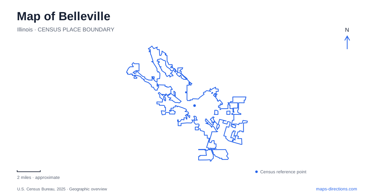
Street tiles load from OpenStreetMap when opened. The blue line shows the 2025 Census boundary.
- State
- Illinois
- Population · July 2025
- 40,237
- Land area
- 23.2 sq mi
- Water area
- 0.3 sq mi
Belleville's public square provides a clear starting point for understanding the city. Main Street meets State Route 159 beside the Veterans Memorial Fountain, while parks and shared-use trails extend the map beyond the downtown streets. Richland Creek supplies one recreational corridor, and the MetroLink railway alignment supplies another. Together, the square, waterways, and transit-related paths show how a historic county seat connects with its surrounding neighborhoods and the wider Metro East region.
The public square and the county seat
George Blair donated an acre for a public square in March 1814, helping bring the St. Clair County seat from Cahokia to a more central location. The county court recognized his chosen town name that August. The square therefore belongs to the community's founding story, rather than being a later ornamental space added to an established downtown.
The Veterans Memorial Fountain gives that civic space its best-known feature. Local Veterans of Foreign Wars members built the original fountain in 1937 to honor American service members. A major restoration began in 1985, followed by rededication in May 1986.
Parts of that history now occupy two places. The original fountain base was moved to Melvin Price Memorial Park in neighboring Swansea, while the restored memorial remains at the central square. Four illuminated flagpoles were added in 1992 around the fountain's quadrants. The landmark seen today thus represents several periods of construction and commemoration.
For visitors reading Belleville's streets, Main Street and Route 159 provide the geographic crossing, while the fountain supplies a visual reference. The founding square and its later memorial express different layers of civic history within the same central location.
Following Richland Creek through the parks
The East Belleville Bikeway follows Richland Creek, with access through North End, Hough, Rotary, and South Side parks. Public sculptures appear along the route, adding an arts element to a corridor used for walking and cycling. At the back of North End Park, it connects with MetroBikeLink.
The city's trail guide also distinguishes a Richland Creek Bike Trail section running from Old Collinsville Road toward MetroBikeLink through Centennial Park. These related names can be confusing if treated as a single park address. They describe a network whose individual sections connect different neighborhoods and access points.
Reading the creek as a continuous landscape helps explain the network. The parks supply places to enter, rest, or use other facilities, while the path carries movement between them. A trip can focus on one park or follow the water corridor across several, without needing to follow the same route as nearby streets.
A railway alignment becomes a regional connection
MetroBikeLink runs beside the MetroLink alignment and connects multiple transit centers across St. Clair County. The transit district describes the route through the Dutch Hollow area as following the former CSX corridor and Schoenberger Creek, where railway and mining history shaped the landscape.
The Tecklenburg Trail provides another connection from 66th and Main through the county forest preserve toward MetroBikeLink near Dutch Hollow and Llewellyn roads. Its bridge crosses both Illinois Route 161 and Schoenberger Creek. This is a useful example of a trail connection whose route is determined by infrastructure and terrain, rather than by a simple continuation of the street grid.
The result is a regional network with local entry points. Rail stations, creek paths, and neighborhood connectors perform different roles, but together they allow the city to be understood at a walking or cycling scale as well as a driving scale.
Two parks organized around water
Bellevue Park, at 401 Bellevue Park Drive, is the city's first park. Its 27 acres include a three-acre fishing lake, gently rolling ground, and a historic stone lodge built during the WPA era. The lodge and lake give the park a recognizable center within its western neighborhood setting.
Bicentennial Park occupies 4811 Belleville Crossing. Its 43 wooded acres, fishing ponds, trails, and splash pad were developed and named in connection with the city's 200th anniversary in 2014. The municipal inventory also identifies an accessible fishing pier, sculptures, and picnic facilities.
These parks represent different moments in the public landscape: an established western park with a Depression-era lodge and a newer commemorative park with several ponds. Neither should be confused with the linear creek trails, although all contribute to the same broader recreation system.
The most useful map of Belleville therefore keeps three structures visible: the civic crossing at the square, the stream and railway corridors, and the larger park destinations. Their relationships explain how the historic center remains connected to landscapes that developed for recreation, transportation, and community gathering.
Map and statistics: U.S. Census Bureau, 2025 Gazetteer, January 2025 generalized place boundaries and Vintage 2025 population estimates. Local references: City of Belleville; St Clair County Transit District. Article prepared by Maps & Directions.