Map of Beavercreek
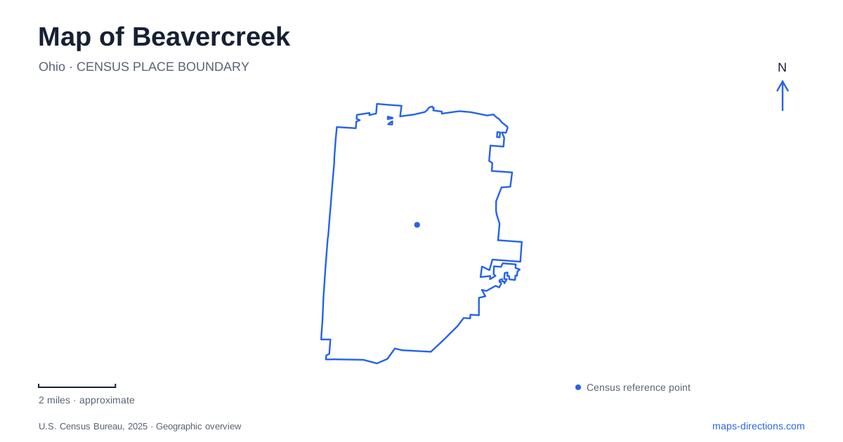
Street tiles load from OpenStreetMap when opened. The blue line shows the 2025 Census boundary.
- State
- Ohio
- Population · July 2025
- 48,134
- Land area
- 26.6 sq mi
- Water area
- 0.0 sq mi
Beavercreek becomes easier to understand when you separate its road network from its east–west recreational corridor. North Fairfield Road provides a useful street reference, while Creekside Trail connects local access points with the wider Dayton–Xenia trail system. Neither line represents the whole community. A shop, a park entrance and a trail meeting point can share a familiar road name yet require different destinations in a route planner. Start with the actual place you intend to reach, then use these two corridors to understand its surroundings.
North Fairfield Road as an organizing line
North Fairfield Road is more than a label beside a trail crossing. City engineering information identifies a section between Pentagon Boulevard and Interstate 675, as well as a separate section between Lawson Drive and Fairwood Drive. Those named limits show why a road-only search is insufficient: a result can place you on the correct corridor without placing you near the intended entrance. Use the building number or cross street to distinguish a northern road destination from one closer to the trail.
For someone comparing several stops, the useful question is which portion of the corridor each stop occupies. Mark each address before choosing an order. Do not assume that a familiar road name implies a short walk between destinations. The road's role in city engineering projects also differs from the trail's recreational purpose; a cycling connection shown near the road is not evidence that the roadway itself provides the same riding conditions.
Follow the former rail corridor
Creekside Trail gives a map of Beavercreek an east–west reference that continues beyond the municipal boundary. The city's bikeway information describes a converted railroad corridor connecting Xenia Station with Eastwood MetroPark in Dayton and following the Route 35 corridor for much of the journey. This explains its broad alignment: the trail follows an established transport corridor rather than weaving through every residential street.
The same route has different names in the two counties. Local information uses Creekside Trail in Greene County and Creekside Recreational Trail in Montgomery County. A change in the map label therefore need not mean that you have selected a different recreational route. When planning a ride across the county line, inspect the continuous path and its junctions rather than searching only one version of the name. Keep the destination trailhead as a separate saved point from the route itself.
Parking and access are different map symbols
The city lists parking at Fifth Third Gateway Park, E.J. Nutter Park and the township's community park on Factory Road. It also identifies access from North Fairfield Road, Geneva Street, Train-Vu and Factory Road. These are not interchangeable promises of parking at every crossing. A person arriving by bicycle can use a path connection that is unsuitable as a meeting place for someone bringing a car.
For a Beavercreek trail outing, agree on a named parking location before sharing a map pin. A pin dropped on the trail's centerline can leave two people on different roads or opposite sides of an access point. Inspect the path between the parking area and the trail, especially when arranging a group ride. The local bikeway map distinguishes parking symbols from walking and cycling access symbols, which is more useful than assuming every visible intersection serves both purposes.
Alpha and the western gateway
Downtown Alpha and Grange Hall Road are additional access references in the city's trail information. They help identify a particular portion of the corridor without treating the entire trail as a single destination. Fifth Third Gateway Park has a more specific address: 4231 Dayton-Xenia Road, on the Greene–Montgomery county line. That county-line setting makes it a helpful western reference when comparing an outing toward Dayton with one toward Xenia.
Beavercreek Station is another named stop along the trail, and the city identifies it as the location of its September 11th Memorial. Search the facility name carefully. A station on a recreational route should not be mistaken for a passenger rail station merely because the trail follows an old railroad alignment. The name identifies a local resting place and memorial context, rather than establishing a current train service.
City, township and trail management
Beavercreek also appears in township and park names beyond the city government's facilities. The trail crosses several jurisdictions, and the city's facility information explicitly distinguishes ownership of its own segment from segments belonging to other local governments. That matters when checking a park reservation, reporting a path issue or confirming the correct entrance. Use the operator named for the particular facility, not the broad place label alone. A useful trip map retains the street address, named access point and intended direction along the corridor together; those details answer different questions that one municipal outline cannot resolve.
Map and statistics: U.S. Census Bureau, 2025 Gazetteer, January 2025 generalized place boundaries and Vintage 2025 population estimates. Local references: City of Beavercreek. Article prepared by Maps & Directions.