Map of Beaumont
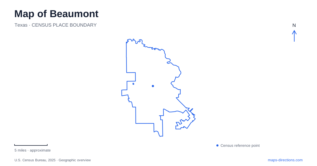
Street tiles load from OpenStreetMap when opened. The blue line shows the 2025 Census boundary.
- State
- Texas
- Population · July 2025
- 112,967
- Land area
- 82.1 sq mi
- Water area
- 2.8 sq mi
Beaumont's map connects an oil-industry history with a riverfront downtown and an extensive wetland landscape. These themes appear in different parts of the city: Main Street holds a downtown energy museum, Lamar University's campus contains the Spindletop Boomtown Museum, and Tyrrell Park provides access to gardens and nearby marshes. Calder Avenue adds a historic residential landmark. Placing those destinations individually creates a clearer picture than treating every oil-related attraction or green space as one district.
Main Street beside the Neches River
The Texas Energy Museum stands at 600 Main Street in the historic downtown area. Its subject is the history and science of Texas oil, making it a useful introduction to the industry that shaped the wider region. This is an indoor downtown destination, distinct from the recreated boomtown setting farther south.
Riverfront Park is listed at 701 Main Street, beside the Neches River and close to the Civic Center. The river gives the downtown map a strong geographical edge, while the museum and civic buildings provide nearby urban reference points. Crockett Street and the theater and museum districts form part of this broader central area.
The riverfront also carries a history of storm damage and recovery. Hurricane Harvey severely damaged the park in 2017, leading to a lengthy closure and restoration. The city reopened it in August 2025. Older descriptions or saved itineraries may therefore portray a different stage of the waterfront's history. The restored park reconnects public activity with the river, making the Neches an active part of a downtown visit rather than simply a blue line beyond the buildings.
Calder Avenue and the McFaddin-Ward House
The McFaddin-Ward House offers another perspective on Beaumont's past. Completed in 1906, the mansion is described by its museum as Beaux-Arts Colonial Revival in style and retains original furnishings. Its domestic interiors, carriage house, and gardens show aspects of household life that differ from the machinery and industrial interpretation found at the energy museums.
The visitor center is at 1906 Calder Avenue. This is a particularly useful address because the museum also publishes an administrative address on Third Street. A person attending a tour should identify the visitor center rather than assume that any address associated with the institution serves the same purpose.
The property supports different kinds of visits. A tour of the historic home involves its interior floors, while the carriage house and garden offer a separate view of the estate. Reading the site in this way helps relate the mansion to its supporting buildings and landscape. The house is more informative when understood as a household complex, rather than only an impressive facade on Calder Avenue.
Spindletop's story on the university campus
On January 10, 1901, the Lucas Gusher erupted at Spindletop Hill. The Boomtown Museum interprets the working and domestic world that followed, including the people who lived around the oil field. Its setting is on the Lamar University campus at 5550 Jimmy Simmons Boulevard, formerly called University Drive, near East Cardinal Drive.
That street-name change is a concrete map issue for visitors using older directions. The museum also publishes separate approaches from Interstate 10 and from northbound US 69. From the interstate, its instructions use the southbound US 69/287/96 corridor toward Port Arthur; from Port Arthur, the approach reaches the museum from the northbound highway side. The service roads and highway orientation therefore matter as much as the general campus label.
For a historical itinerary in Beaumont, the downtown Texas Energy Museum and the campus boomtown complement each other. One presents the larger petroleum story in the central museum district; the other places the early oil boom within a reconstructed working community. Their subjects overlap, but their locations and ways of presenting the history are different.
Tyrrell Park and the engineered marsh landscape
Tyrrell Park's published address is 6088 Babe Zaharias Drive. The botanical gardens at the park entrance include the Warren Loose Conservatory, themed plantings, and a paved Friendship Walk. These are cultivated garden spaces, with paths arranged for viewing plants rather than following a riverbank.
Nearby Cattail Marsh has a very different origin. Constructed in 1993 as part of the municipal wastewater treatment system, it combines engineered wetland functions with wildlife habitat. Its boardwalk includes covered viewing platforms, and the education center overlooks the marsh. Gravel levee roads provide a wider network for exploring the wetland landscape.
This combination is a distinctive part of Beaumont: infrastructure and nature observation share the same setting. The levees and water cells help explain the shape of the paths visible on a map. A garden walk, a boardwalk visit, and a longer levee outing are different experiences within the broader park and wetland area. Together with the Neches riverfront and the two petroleum museums, they show how water and industry remain central to understanding Beaumont's geography.
Map and statistics: U.S. Census Bureau, 2025 Gazetteer, January 2025 generalized place boundaries and Vintage 2025 population estimates. Local references: Texas Energy Museum; Beaumont Convention and Visitors Bureau; City of Beaumont; McFaddin-Ward House Museum; Lamar University. Article prepared by Maps & Directions.