Map of Baytown
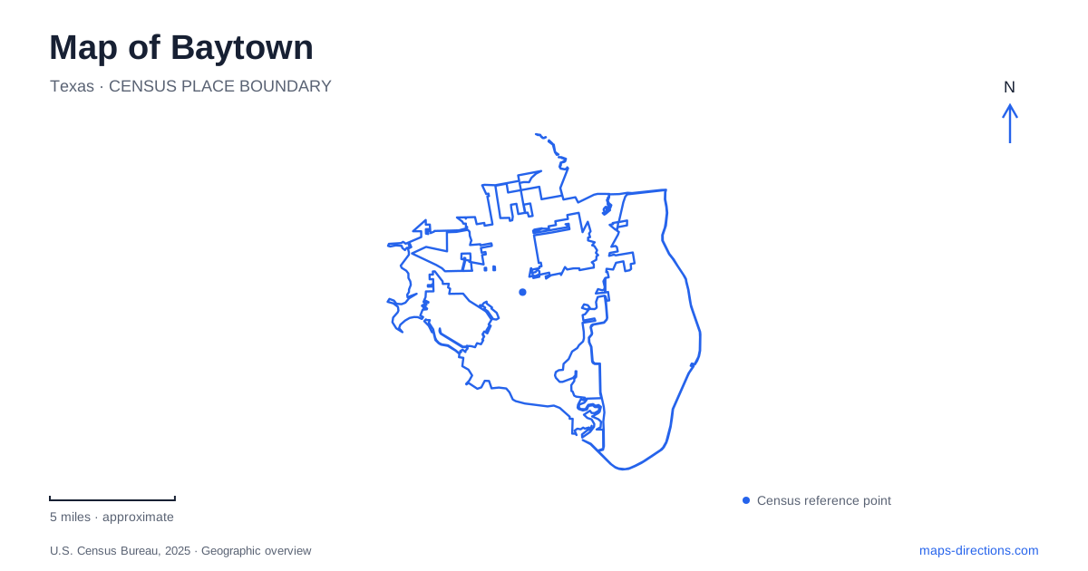
Street tiles load from OpenStreetMap when opened. The blue line shows the 2025 Census boundary.
- State
- Texas
- Population · July 2025
- 86,561
- Land area
- 40.0 sq mi
- Water area
- 1.3 sq mi
Baytown's present-day map combines older communities, industrial growth and a shoreline that has changed in response to flooding and land subsidence. Goose Creek and Pelly were once separate civic identities, and the consolidated city received its charter in 1948. Their names still help explain the urban landscape. Water provides another organizing pattern: Goose Creek reaches Tabbs Bay, while the former Brownwood neighborhood occupies a peninsula among several other bays. Understanding these relationships gives the city's parks and historic places more meaning than isolated map markers can provide.
Texas Avenue preserves the Goose Creek center
The local tourism office identifies Texas Avenue with the early-twentieth-century Goose Creek boomtown that developed around the oilfield. The street's present cultural activity sits within that inherited commercial setting. The historical museum occupies the former Goose Creek post office, preserving another connection between an older civic identity and a current public use.
This is an important part of Baytown's geography because consolidation did not erase every earlier center. A former post office or commercial street can continue to structure a neighborhood after municipal boundaries and names change. Looking at Texas Avenue through that history explains why downtown heritage is concentrated here. The buildings record a community that developed before the larger city's current identity, while their later uses keep that history present in daily urban life.
Bayland Park marks the creek's southern end
Bayland Park is at 2641 South State Highway 146 Business, north of the marina. Its waterfront setting overlooks Tabbs Bay at the mouth of Goose Creek. The city lists public boat ramps and a kayak launch, alongside picnic areas, pavilions and a hilltop gazebo. It is a place where a creek corridor meets a larger bay landscape.
The park also marks the southern end of Goose Creek Trail. The paved route connects with other parks and passes through residential, commercial and wooded areas. That makes Bayland more than a waterfront endpoint: it is part of an inland connection through different kinds of urban space. On a map, following the creek north from the bay reveals a useful organizing line that is separate from the main roads. The trail's geography helps relate several public places that otherwise appear disconnected.
A bowling alley became a wetlands classroom
The Eddie V. Gray Wetlands Center opened in January 1998 on the banks of Goose Creek at 1724 Market Street. Its origin is unusually specific: an abandoned bowling alley was acquired and converted into an education center. The six-acre property includes a building with exhibits, meeting space and a science laboratory, supported through cooperation among the city, school district and Lee College.
For Baytown, the center connects environmental interpretation with the reuse of an existing urban building. Its exhibits cover local wetland life, including birds, snakes, alligators and fresh- and saltwater inhabitants. The location beside the creek reinforces the subject of the displays. This is a different experience from exploring a large outdoor preserve, even though both kinds of destination can carry “wetlands” or “nature” in their descriptions. The Market Street address identifies an educational facility within the developed city.
Brownwood's residential landscape became a preserve
The nature center at 6213 Bayway Drive occupies the former Brownwood subdivision. Land subsidence and repeated flooding undermined the neighborhood, and Hurricane Alicia caused extensive damage in 1983. A government-supported acquisition program followed, allowing the area to move away from residential use and toward habitat restoration and public open space.
That history changes how the peninsula should be read. Its present marshes, trails and open areas are not simply untouched land beside an industrial city. They occupy a landscape where people once lived and where environmental change forced difficult decisions. Baytown's relationship with the water is therefore visible not only in recreation facilities but also in the absence of former housing. The preserve records both ecological recovery and the loss of a neighborhood.
Today, the peninsula is bordered by Burnet, Crystal and Scott's bays. The city describes trails through hardwood forest, tidal marsh and wetlands, with places such as Wooster Point and Golden Bloom Pond providing smaller geographic references. Those named features help distinguish different parts of the preserve instead of treating the entire peninsula as one destination. Its shoreline setting also differs from Bayland Park's location at the mouth of Goose Creek.
Wooster School survives in a new setting
The 1894 Wooster School was originally built near what is now Arbor Street and Bayway Drive. Its history includes periods of closure and reuse as the surrounding community's educational needs changed. In 1986, the building was moved to Republic of Texas Plaza, and restoration was completed the following year. It now serves as a living-history museum.
The school is a reminder that a preserved building's current location may not be its original one. Comparing the original corner with the plaza shows the difference between the history of a structure and the history of a site. Together with the old post office, converted bowling alley and former Brownwood subdivision, it gives Baytown a distinctive map of adaptation: buildings, neighborhoods and public spaces have repeatedly changed purpose while retaining evidence of earlier lives.
Map and statistics: U.S. Census Bureau, 2025 Gazetteer, January 2025 generalized place boundaries and Vintage 2025 population estimates. Local references: City of Baytown; Visit Baytown; Baytown Historical Preservation Association. Article prepared by Maps & Directions.