Map of Baton Rouge
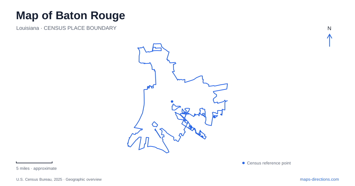
Street tiles load from OpenStreetMap when opened. The blue line shows the 2025 Census boundary.
- State
- Louisiana
- Population · July 2025
- 222,795
- Land area
- 86.4 sq mi
- Water area
- 2.2 sq mi
Baton Rouge is organized around a riverfront capital district, but its map also contains university grounds, residential neighborhoods and conserved wetland habitats. The Mississippi provides the clearest large-scale reference. Beside it, two very different capitol buildings mark successive periods of state government, while the levee creates a long recreational corridor extending south. Farther inland, the landscape changes again, revealing why the city is more than the collection of government buildings visible along the river.
Two capitols, two architectural landmarks
Louisiana's Old State Capitol stands on a bluff overlooking the Mississippi. Its Gothic form gives it the appearance of a castle, a striking contrast with the tall twentieth-century capitol farther north. The old building's address, at North Boulevard and River Road, places it directly within the downtown riverfront setting. Restored and reopened in 1994 as a political-history museum, it now interprets the governmental past rather than serving as the state's legislative workplace.
The newer State Capitol was dedicated in May 1932, following a construction period of fourteen months. Its address on North Third Street identifies a separate destination within the capital district. The contrast between the two buildings makes the change in governmental scale unusually visible: one landmark faces the river from a bluff, while the other rises prominently above the surrounding city. Current renovations affect visitor circulation at the newer building, so its main front steps and observation deck should not be assumed available simply because tours continue.
Downtown includes residential streets
Historic Spanish Town and Historic Beauregard Town are part of downtown Baton Rouge alongside its central business district. Spanish Town lies to the north of the commercial core and Beauregard Town to the south. Their presence gives the district a residential history that is easy to overlook when a map emphasizes offices, museums and large public buildings.
Beauregard Town's original plan included diagonal streets linking a proposed central religious site with other civic institutions. Municipal planning documents explain the intended connections to a government building, hospital, college and convent, along with boulevards leading toward the river. The design is useful historical context for unusual street angles: these were elements of an ambitious planned town, not random interruptions in a rectangular grid. Reading the neighborhood through that plan adds meaning to its surviving street geometry.
The levee as a continuous southward reference
The Mississippi River Levee Trail connects downtown with the LSU area and continues toward the southern end of the parish. The Downtown Development District describes a roughly thirteen-mile paved corridor, with designated space for cycling and walking. Its alignment follows the river-defense landscape, giving recreational users a route whose purpose and shape differ from those of ordinary city streets.
The Downtown Greenway is a separate network linking parks, neighborhoods and cultural destinations. Its published plan extends beyond the portions already completed, an important distinction when looking at diagrams of the full proposed network. Together, the levee route and established greenway segments create connections within Baton Rouge that are not apparent from a highway map. The river corridor offers continuity along the water, while the urban links reach into the street network.
The university's much older landmarks
LSU's campus includes two Native American earthen mounds that predate the university by thousands of years. They were already significant features when the institution moved to its present campus in the 1920s. Their presence adds a much deeper history to a place often associated primarily with modern academic buildings and athletics.
The university identifies the mounds as sacred and ceremonial places and asks visitors to view them from outside protective barriers. Informational panels on the surrounding fence support interpretation without climbing on the earthworks. Their exact construction chronology remains a subject of research, so their importance does not depend on presenting a disputed superlative about their age. On a map of Baton Rouge, the mounds should be understood as protected cultural sites within the campus, not ordinary grassy hills intended for play or seating.
A swamp within the developed landscape
Bluebonnet Swamp Nature Center protects about 103 acres near Bluebonnet Boulevard between Perkins Road and Highland Road. Its entrance address is on North Oak Hills Parkway. BREC identifies cypress-tupelo swamp, beech-magnolia forest and other hardwood habitats within the conservation area, connected by more than a mile of gravel paths and boardwalks.
The combination of woodland and wet ground explains the mixture of walking surfaces. Boardwalk sections cross places where a conventional dry path would not express or accommodate the habitat in the same way. The nature center's exhibits complement that outdoor landscape with information about local plants, animals and natural materials. This inland conservation site gives Baton Rouge another geographic dimension: the large riverfront and the smaller wetland environments are different, equally tangible parts of the city's relationship with water.
Map and statistics: U.S. Census Bureau, 2025 Gazetteer, January 2025 generalized place boundaries and Vintage 2025 population estimates. Local references: Louisiana Secretary of State; Louisiana Old State Capitol; Louisiana House of Representatives; Visit Baton Rouge; Baton Rouge Area Chamber; Downtown Development District; Louisiana State University; BREC. Article prepared by Maps & Directions.