Map of Bakersfield
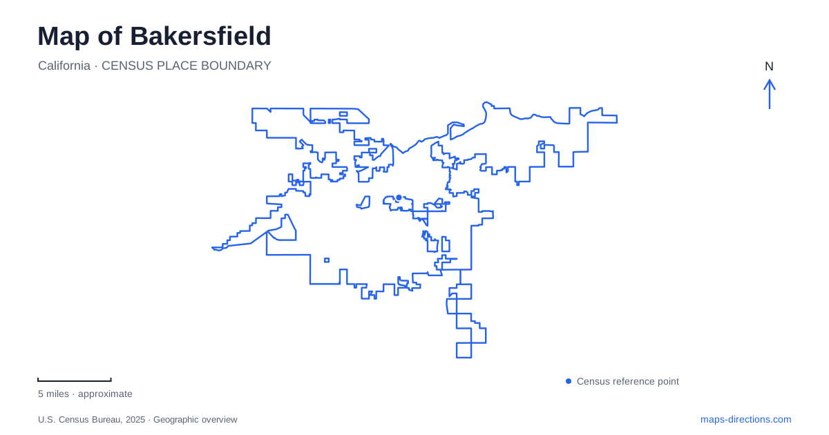
Street tiles load from OpenStreetMap when opened. The blue line shows the 2025 Census boundary.
- State
- California
- Population · July 2025
- 422,165
- Land area
- 150.4 sq mi
- Water area
- 1.5 sq mi
Bakersfield is easier to understand when its river corridor, downtown grid, and regional roads are read as separate but connected systems. Chester Avenue provides a useful cultural reference, the Kern River Parkway links recreation spaces, and the freeway network organizes longer movements across the urban area. Farther northeast, county parks introduce a different landscape along the river. Each system uses some of the same familiar place names, but they operate at different scales.
Downtown history occupies several blocks
The Fox Theater at 2001 H Street supplies a clear downtown landmark. Nearby historic destinations identified in the local historical trail include the Padre Hotel, Haberfelde Building, Kress Building, Standard Oil Building, and former Woolworth building. Together they show a center shaped by entertainment, hotels, retail, and business rather than by one dominant civic square.
Numbered streets and named or lettered north–south streets help organize these sites. A walk centered on H Street and the surrounding numbered blocks has a different scale from a drive to the museums farther along Chester Avenue. Keeping those locations distinct prevents the broad label “downtown” from obscuring the actual distance between destinations.
Historic building names may also remain in use after their original commercial role has changed. On a Bakersfield map, the Woolworth or Standard Oil label can function as a heritage reference as well as a building identifier. The historical trail is useful because it relates those names to specific surviving structures rather than treating them as separate neighborhoods.
Chester Avenue holds a collection of relocated history
The Kern County Museum occupies 3801 Chester Avenue. Its Pioneer Village contains more than fifty historic structures and exhibits across sixteen acres. The grounds recreate a village-like setting, but the buildings did not all originate together at this location.
The general store, for example, was built in the rural community of Woody in 1926 and moved to the museum in 1957. The Lopez Hill House began as a Chester Avenue home in 1903 and was moved several times before its donation. Those histories make the museum a gathering place for material from across the county.
This distinction is useful when reading both the museum map and the city map. A building's position within Pioneer Village explains where it can be visited now, while its original location explains the community story it represents. The entrance through the Aera Energy Gallery introduces that wider regional context before visitors move through the outdoor collection.
The river is a corridor, not a promise of water
The Kern River Parkway gives Bakersfield an extensive route for walking and cycling. City bicycle planning documents identify the principal shared-use corridor between Enos Lane and China Grade Loop, with access links from streets and parks. The Park at River Walk and an Oak Street access path are examples of places where the local street network meets the broader river route.
The river's mapped channel should not be interpreted as a guarantee of continuous surface water. Municipal operations involve weirs, sediment management, maintenance, and changing flows. The Bellevue Weir near the Park at River Walk and infrastructure near Coffee Road illustrate how the river is also a managed water system.
For a recreational map, this means the channel, trail, and access points each convey different information. A blue river line locates the watercourse; a path line describes a potential route; and named park connections show where a neighborhood outing can join it. These features remain geographically important even when the visible water changes.
County recreation continues northeast
Hart Memorial Park lies on Alfred Harrell Highway northeast of the central city. Dedicated in 1929 and later renamed for county supervisor John O. Hart, it forms the centerpiece of the larger Kern River County Park complex.
Lake Ming, reached by Lake Ming Road from Alfred Harrell Highway, is another component of that recreational area. The nearby California Living Museum adds a separate destination. These names can appear close together on a regional map, but they identify different facilities within a wider landscape rather than interchangeable entrances to one park.
The distinction between the urban river path and the county recreation complex is particularly helpful for a Bakersfield visit. A riverside outing near downtown, a stop at Hart Park, and a trip to Lake Ming can all involve the Kern River setting without starting from the same road or parking area.
Freeway names describe a wider network
State Route 99 and State Route 58 are major references for regional navigation. The Centennial Corridor connects the Route 58 freeway with Westside Parkway, tying previously separate sections into an east–west route. Individual interchange movements and local exits still need to be read from a current road map.
These larger roads provide the outer framework, while Chester Avenue, downtown cross streets, river paths, and Alfred Harrell Highway explain more specific destinations. Combining those scales produces a practical map of Bakersfield: regional approaches establish the general journey, and the city's cultural and natural corridors give it local meaning.
Map and statistics: U.S. Census Bureau, 2025 Gazetteer, January 2025 generalized place boundaries and Vintage 2025 population estimates. Local references: Visit Bakersfield; Kern County Museum; City of Bakersfield; Kern County. Article prepared by Maps & Directions.