Map of Aventura
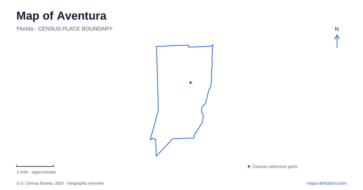
Street tiles load from OpenStreetMap when opened. The blue line shows the 2025 Census boundary.
- State
- Florida
- Population · July 2025
- 39,880
- Land area
- 2.6 sq mi
- Water area
- 0.9 sq mi
Aventura's map is organized around large, recognizable places: the Turnberry golf landscape, the surrounding Country Club Drive loop, a major shopping complex and a series of civic parks. These features give the city a different pattern from an older town built around a courthouse square. Public paths, recreation grounds, private development and regional transportation sit close together, but each has its own role and internal layout.
The loop around the golf landscape
The Don Soffer Exercise Trail circles the Turnberry Isle golf course along Country Club Drive. The city describes a 3.1-mile paved loop, approximately ten feet wide, with shade trees, benches, water fountains and marked crossings. It is open to the public and provides a continuous reference feature around the large interior golf landscape.
This arrangement is particularly useful for understanding Aventura. The public route follows the perimeter rather than cutting across the fairways. A golf-course label and a trail label may therefore occupy nearly the same area on a small map while describing quite different access. The loop connects exercise and everyday movement with views into a landscape whose interior has a separate recreational purpose.
Founders Park and the city's incorporation
Founders Park lies south of the Lehman Causeway and east of West Country Club Drive. Its central monument commemorates the people associated with incorporation in November 1995. The park's name records the formation of the municipal government, rather than suggesting an ancient settlement site.
The northern park area contains playgrounds, an athletic field, tennis facilities and a short exercise route. The city also distinguishes a southern section, known as the bayside area. That internal division matters because the entire park name covers more than one kind of recreation space. The address at 3105 Northeast 190th Street places the main destination within the street network, while the causeway and Country Club Drive supply broader orientation.
Waterways Park and the school-day relationship
Waterways Park occupies seven acres at 3301 Northeast 213th Street. Its facilities include a covered playground, shaded picnic space, an exercise path and a multipurpose athletic field. The municipal listing also identifies a practical relationship with the neighboring high school: during school days, general park access begins after the school-day period, while weekends and school holidays follow a different schedule.
This is a specific local example of why a green area on a map does not explain every condition of use. The park serves recreation, but its relationship with the adjacent educational campus affects access. It should also be distinguished from Waterways Dog Park, which the city lists as a separate facility. Similar names identify related civic amenities, not interchangeable destinations.
Art within the shopping complex
Aventura Mall includes outdoor spaces and a collection of artworks in addition to its shops. In the courtyard near Apple, the landscape design incorporates trees such as mahogany, black ironwood and white tabebuia. Carsten Höller's tall slide sculpture and the Haas Brothers' Gorillas in the Mist form recognizable parts of this setting.
The courtyard gives the large commercial complex an internal geography of its own. A person looking for an artwork or outdoor gathering space needs a more precise reference than the mall's overall footprint. The sculptures, planted areas and entrances organize movement at a different scale from the surrounding city streets. They also show how the shopping destination combines retail functions with designed social and cultural spaces.
A separate performing-arts address
The Arts and Cultural Center is at 3385 Northeast 188th Street, apart from the shopping complex. Its operator identifies adjacent parking near the community recreation center and the nearby school. Those neighboring institutions create a civic cluster with a different purpose from the mall's galleries, sculptures and retail courtyards.
On an Aventura map, cultural activity therefore appears in more than one setting. Public performances take place at the dedicated venue, while visual artworks are also incorporated into commercial space. Treating them as distinct destinations helps explain the city's variety without implying that every arts event occurs inside the shopping center.
Regional rail and the final connection
Brightline lists its local station at 19796 West Dixie Highway. The station is a rail destination in its own right, with passenger facilities and parking; it is not an entrance inside the mall. Its name associates it with the surrounding area, but the street address is the more precise reference for boarding a train.
The operator offers shuttles for selected stadium games and events, identified during booking. Such event services should not be mistaken for a general shuttle to every nearby attraction. The station, mall, civic venues and recreation loop remain separate places even when they are combined into one outing.
A map of Aventura is most informative when it keeps those scales visible: the broad golf-course loop, individual municipal parks, internal shopping-center landmarks, the civic arts cluster and the regional rail stop. Together they explain how a compact area accommodates several different patterns of movement and public life.
Map and statistics: U.S. Census Bureau, 2025 Gazetteer, January 2025 generalized place boundaries and Vintage 2025 population estimates. Local references: City of Aventura; Aventura Mall; Arts and Cultural Center; Brightline. Article prepared by Maps & Directions.