Map of Aurora
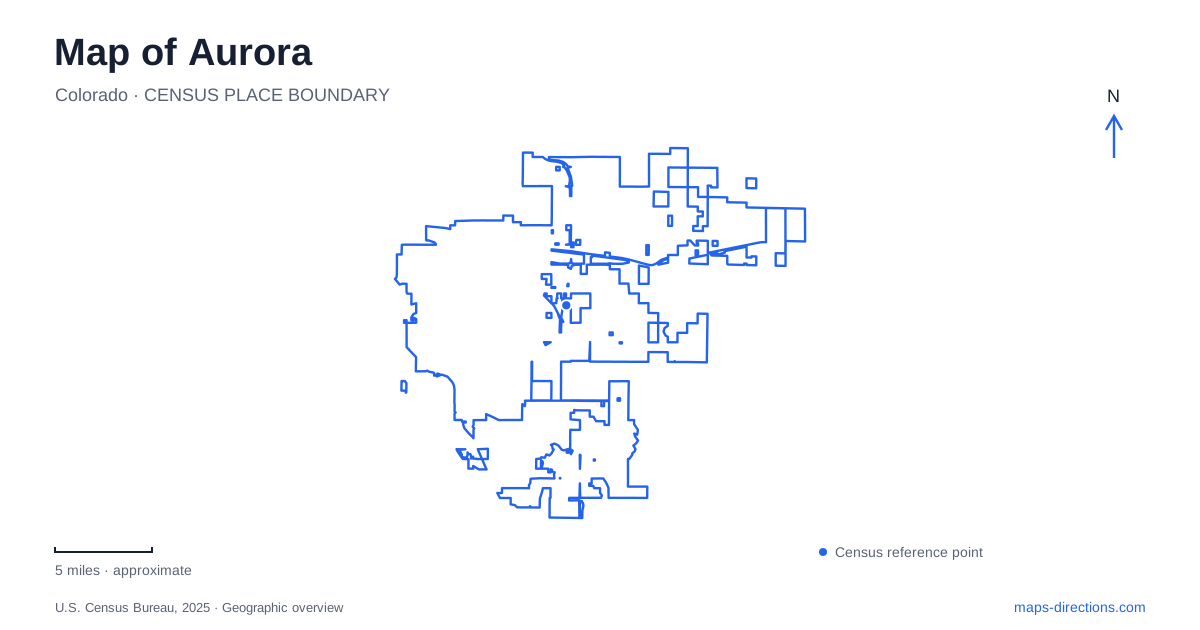
Street tiles load from OpenStreetMap when opened. The blue line shows the 2025 Census boundary.
- State
- Colorado
- Population · July 2025
- 410,053
- Land area
- 164.1 sq mi
- Water area
- 0.6 sq mi
Aurora has a historic commercial corridor, a major medical campus, suburban creek trails, and large open-water recreation areas. These places are spread across different parts of the city, so a single central marker gives little sense of their relationships. East Colfax Avenue explains the original settlement, while waterways and open spaces reveal another network that cuts across the street system. Reading both layers helps connect the older urban core with the wider landscape.
East Colfax records the original town
The settlement incorporated as Fletcher in 1891 occupied a much smaller area than the present city. Its original townsite was bounded by what are now East Sixth Avenue, East 26th Avenue, Peoria Street, and Yosemite Street. Those streets provide a concrete way to locate the early community within today's much broader map.
Residents changed the town's name to Aurora in 1907. East Colfax remained an important commercial and transport corridor, with early streetcar service linking the settlement westward to Denver. The historic center therefore developed along a regional avenue rather than around the later civic and retail areas farther east.
The cultural arts district continues to identify East Colfax as a historic arts corridor. Fletcher Plaza, the Fox Arts Center, and the People's Building provide recognizable references. The old town boundaries and these cultural sites help explain why this portion of the city has a different street character from newer neighborhoods.
Anschutz is a campus within the city
The Anschutz medical campus occupies the former Fitzsimons site, where development of the modern university and hospital facilities began in 2000. Its location adds another major activity center near the Colfax corridor, but its internal geography is more complex than a single hospital symbol suggests.
The university lists its campus address on East 17th Place and publishes separate maps for visitor parking, permit areas, transit stops, bicycle parking, and other facilities. Those maps reflect a setting with many buildings and several ways of arriving. For a medical appointment or university visit, the building name is therefore an essential part of the destination.
A city map establishes the campus's broader relationship to surrounding roads; a campus map explains the final connection. This distinction is especially useful where several institutions share a large site and an address search may otherwise emphasize the general campus location.
Creek trails connect neighborhoods and historic land
Tollgate Creek Trail runs north from the Quincy Reservoir area to the High Line Canal Trail at DeLaney Farm. The farm, at 170 South Chambers Road, combines open space with historic structures, including the round barn. It is both a local heritage destination and a junction within the recreational network.
Piney Creek Trail creates a different connection from Cherry Creek State Park through the southeastern neighborhoods. The Cherry Creek Spillway Trail also links the state park with the city's trail system, following land originally developed for flood mitigation.
These corridors show how an Aurora map can be read beyond its major avenues. Creeks, a canal, and a spillway form routes with their own continuity, often connecting parks that look isolated in a road-only view. The names describe distinct waterways and infrastructure, so they should not be treated as interchangeable sections of one trail.
Cottonwoods and reservoirs offer different landscapes
Star K Ranch lies along Sand Creek and contains the Morrison Nature Center at 16002 East Smith Road. Cottonwood woodland, wetlands, and prairie occur within this setting. The nearby Sand Creek Greenway provides a longer corridor, while the nature center's local trail map explains shorter walks through the ranch.
Quincy Reservoir, at 18350 East Quincy Avenue, occupies a neighborhood setting with a soft-surface trail. Aurora Reservoir is a separate destination at 5800 South Powhaton Road, with a paved perimeter route and the Senac Creek Nature Center. Confusing the two names would mean choosing a different park and a different kind of outing.
The reservoir on Powhaton Road also supports a wider range of designated recreation spaces, including boating facilities, a seasonal swimming beach, and fishing access. Its perimeter trail relates to the whole shoreline, while individual facilities concentrate at particular parts of the grounds. The nature center adds interpretation of water and the surrounding prairie.
Taken together, these places reveal the varied structure of Aurora. The original Colfax settlement, the medical campus, creek connections, cottonwood landscape, and separate reservoirs each contribute a different map pattern. Understanding their locations first makes it easier to choose a route suited to the actual destination rather than relying on the city's name alone.
Map and statistics: U.S. Census Bureau, 2025 Gazetteer, January 2025 generalized place boundaries and Vintage 2025 population estimates. Local references: City of Aurora; Aurora Cultural Arts District; University of Colorado Anschutz. Article prepared by Maps & Directions.