Map of Atlantic City
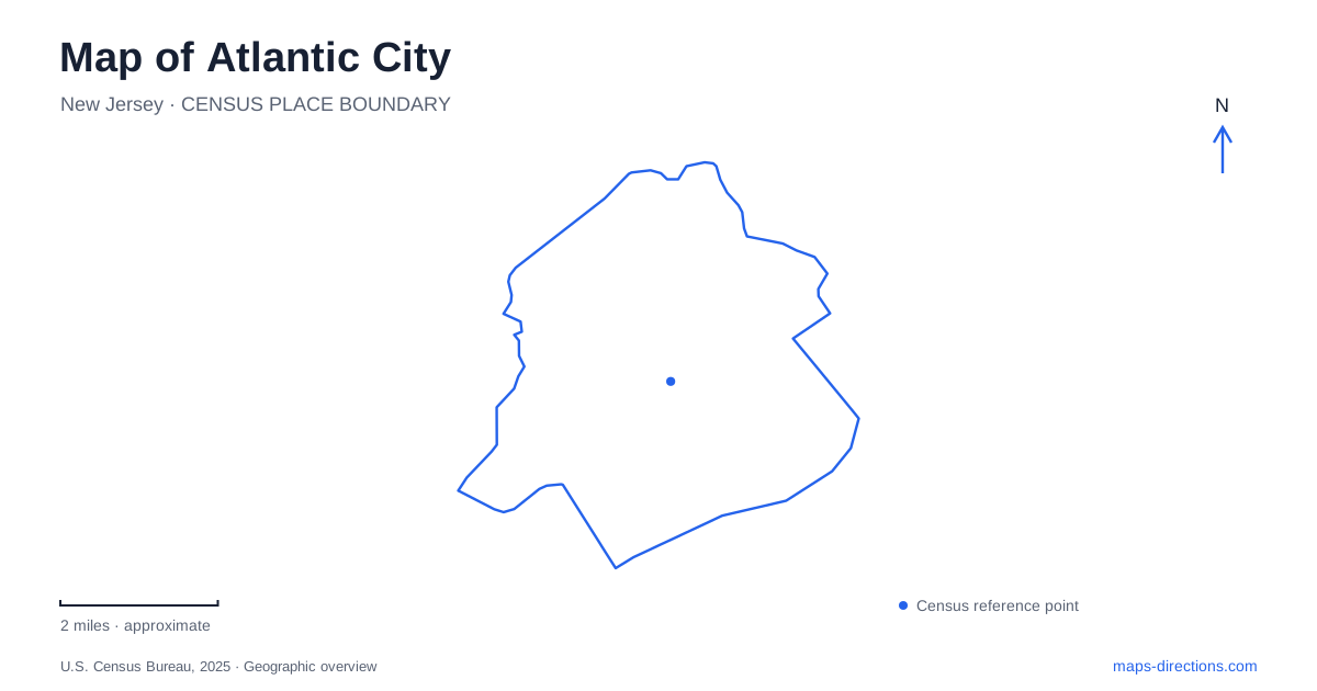
Street tiles load from OpenStreetMap when opened. The blue line shows the 2025 Census boundary.
- State
- New Jersey
- Population · July 2025
- 38,787
- Land area
- 10.8 sq mi
- Water area
- 6.5 sq mi
Atlantic City has several waterfronts, and they serve different purposes. The ocean-facing Boardwalk, the inlet near the northern end of Absecon Island, and the sheltered basin and marina settings should not be collapsed into one strip of attractions. The street grid connects them, but water edges, large buildings and transport facilities shape how each district is approached. The city's history also reaches well beyond the casino era. Its official account describes Lenni-Lenape seasonal use of the island before European settlement, followed much later by the railway that brought visitors from Camden in 1854. That sequence matters because the resort was built upon an already used coastal landscape, not an empty island awaiting development.
A street grid with a coastal logic
The municipal history credits Jonathan Pitney with a naming scheme that used bodies of water for avenues parallel to the ocean and state names for crossing streets. Atlantic, Pacific, Baltic and Arctic are therefore more than familiar words: they help explain the grid's relationship to the shoreline.
The scheme supplies a useful orientation rule, although it does not replace a specific address. Large resort properties can occupy several blocks, while entrances may face a different street from the most prominent facade. A building visible from the Boardwalk can still have vehicle access elsewhere.
Reading Atlantic City this way makes the distinction between beachfront movement and inland arrival clearer. The Boardwalk organizes the ocean edge, while the avenues behind it distribute traffic and connect neighborhoods. A short map distance across a large property is not automatically a public passage through it.
Two convention destinations with different settings
Jim Whelan Boardwalk Hall belongs to the oceanfront landscape. Dedicated on May 31, 1929, it was conceived as a large, self-contained entertainment facility on the former Rendezvous Park site. Its history includes conventions and major performances, which explains why older references may describe it in convention-related terms.
The present Convention Center and adjacent rail terminal are a separate destination inland. NJ TRANSIT identifies the terminal as the end of its route from Philadelphia's 30th Street Station. Arriving by train therefore places a visitor at the convention district, not directly at the Boardwalk Hall entrance.
This distinction is especially important when an event listing uses only a shortened venue name. The two facilities have different footprints, approaches and relationships to the shore. The event's actual building name should determine the destination, even when a historic account uses a similar description for the older hall.
Absecon Lighthouse and a changing shoreline
Absecon Lighthouse stands at 31 South Rhode Island Avenue. Its operator dates the first lighting to January 15, 1857, and identifies the original first-order Fresnel lens still at the top. The tower ceased official lighthouse service in 1933, although its lens is illuminated for visitors to appreciate today.
The site is also evidence that a coast is not a fixed line. The lighthouse history describes erosion bringing the water close to the tower in the nineteenth century, followed by protective jetties and changes in accumulated sand. The current distance from the beach cannot be projected unchanged into every historical photograph or map.
For Atlantic City, the tower supplies a landmark with both maritime and neighborhood significance. The reconstructed keeper's house serves the interpretation of that history, while the tower itself represents the surviving navigation structure. Treating every building on the grounds as equally old would blur the restoration story.
Gardner's Basin and the reopened aquarium
Gardner's Basin introduces a different waterside setting from the open-ocean Boardwalk. The city describes a nautical park with recreational and commercial marinas, businesses and the aquarium. Its address for the aquarium is 800 North New Hampshire Avenue, a useful destination reference within the broader basin.
The aquarium reopened on March 24, 2025 after a five-year closure and extensive work. That restoration is part of the waterfront's history, while the city's aquarium visitor information establishes the admission arrangements for an outing. Distinguishing those two sources avoids using an old construction announcement as an operating calendar.
The exhibits emphasize aquatic life, including regional species, while the surrounding marina setting relates to working and recreational boats. That combination gives Atlantic City a waterfront experience distinct from the beachfront entertainment buildings. The aquarium pin identifies one facility; it does not stand for every business, dock or parking arrangement around the basin.
The inlet separates islands
Absecon Inlet divides Absecon Island from Brigantine Island. On a regional map the opposite shoreline can look close enough to belong to the same uninterrupted beachfront. The water channel explains why reaching it requires an actual road connection rather than continuing along a shore path.
Keeping that separation in view also helps organize the northern attractions. The lighthouse, basin and inlet relate to one another, but they remain separate sites with their own entrances and uses.
A map of Atlantic City is most informative when the oceanfront, inland convention district and northern maritime places retain their individual identities. Their different histories and physical settings explain why a single resort label never tells the whole story of the island.
Map and statistics: U.S. Census Bureau, 2025 Gazetteer, January 2025 generalized place boundaries and Vintage 2025 population estimates. Local references: City of Atlantic City; Jim Whelan Boardwalk Hall; NJ TRANSIT; Absecon Lighthouse; New Jersey Office of Emergency Management. Article prepared by Maps & Directions.