Map of Atlanta
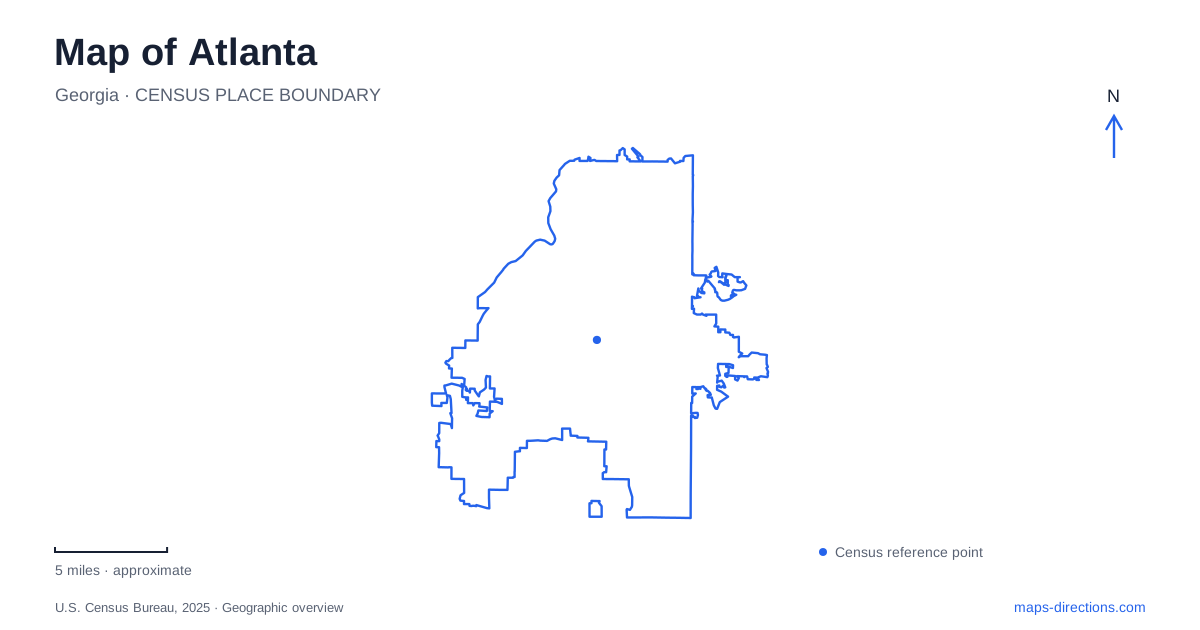
Street tiles load from OpenStreetMap when opened. The blue line shows the 2025 Census boundary.
- State
- Georgia
- Population · July 2025
- 529,110
- Land area
- 135.3 sq mi
- Water area
- 1.1 sq mi
Atlanta's map is best understood as a collection of connected districts rather than a single compact center. Downtown, Midtown, and Buckhead form a useful sequence along the Peachtree corridor, while neighborhoods east and west introduce their own streets and landmarks. The Beltline adds a second network shaped by former rail corridors. This combination explains why a road map, a transit diagram, and a neighborhood trail map can each reveal a different part of the same journey.
Peachtree links three major districts
The official visitor bureau uses the Peachtree corridor to connect Downtown, Midtown, and Buckhead. This is a useful first orientation because the three names describe different areas, not competing names for the same city center. A hotel or destination described as being near Peachtree still needs a district and complete address to establish its position.
Midtown's business district has a more specific local framework. Midtown Alliance describes its core area as the blocks between Piedmont Park and the interstate, extending from the vicinity of Emory University Hospital Midtown toward the Peachtree Street Bridge. That outline places the park at one edge of the district rather than at its center.
For an Atlanta itinerary, this distinction helps separate a visit to a cultural or business address along Peachtree from time spent inside the park. The corridor provides continuity, but the cross streets and adjoining districts supply the actual shape of the trip.
Downtown has a park-centered visitor cluster
Centennial Olympic Park forms a recognizable downtown reference. The Georgia World Congress Center Authority's map places the Georgia Aquarium and World of Coca-Cola along the northern side of the park area, with the College Football Hall of Fame toward its western side. Baker Street, Marietta Street, and Centennial Olympic Park Drive help locate the surrounding blocks.
Within the park, the Fountain of Rings, Great Lawn, and different plazas create a smaller internal geography. This matters when two people agree to meet “at the park”: the name describes a substantial public space with several distinct features. Choosing one of those landmarks makes the meeting location clear without requiring a full street address.
Five Points provides a separate downtown reference on the transit network. MARTA's Red, Gold, Blue, and Green rail lines meet there. Its role is a transfer point rather than a shorthand for every downtown attraction. Reading the station network alongside the park district shows how a rail journey and a final walk can belong to different parts of the same plan.
Piedmont Park joins streets, water, and open space
Piedmont Avenue, Monroe Drive, and Tenth Street frame the principal approaches to Piedmont Park. The conservancy's map identifies gates on Piedmont Avenue, the Charles Allen Drive gate from Tenth Street, and connections to the Beltline. These create several ways into the park from surrounding neighborhoods.
Inside, Lake Clara Meer, the Active Oval, Oak Hill, and the Meadow are distinct destination areas. Their names are useful because the park's recreational spaces do not follow the surrounding street grid. A walk around the lake and a visit to the playing fields can begin from different gates even when both are described as a Piedmont Park outing.
This is one reason Atlanta benefits from a detailed park layer. The city map locates the green space in Midtown; the park map explains how its paths, lake, activity areas, and trail connections fit together.
The Eastside Trail follows a former rail corridor
The Eastside Trail extends from the tip of Piedmont Park to Reynoldstown. It was the first completed Beltline section in the old rail corridor and combines a multi-use path with linear green space. Its route connects with neighborhoods including Old Fourth Ward, Inman Park, and Poncey-Highland.
Ponce City Market and Krog Street Market are recognizable destinations along this corridor, while Historic Fourth Ward Park provides a connection to another substantial public landscape. Access points at streets such as North Avenue, North Highland Avenue, and Edgewood Avenue show how the trail meets the ordinary street network.
For Atlanta walkers and cyclists, the important feature is that the corridor supplies continuity between neighborhoods. It should not be interpreted as a vehicle road, nor should its name be taken to mean that every segment of the wider Beltline network has the same form. The named Eastside section gives a precise starting framework.
Auburn Avenue preserves a neighborhood context
The Martin Luther King, Jr. National Historical Park centers on places within the Auburn Avenue neighborhood. The birth home stands at 501 Auburn Avenue, and the wider group of sites includes historic Ebenezer Baptist Church, Fire Station Number 6, and the King Center.
These places are meaningful in relation to one another. The birth home was part of a residential street, and the church was connected to the family's life within that neighborhood. A map that retains the surrounding blocks helps communicate that context more effectively than treating the park as one detached monument.
A map of Atlanta can therefore organize several different experiences without flattening them together: the Peachtree district sequence, a downtown attraction cluster, Piedmont Park's internal paths, a rail-corridor trail, and Auburn Avenue's historic neighborhood. The connections between these areas explain the city as much as the individual landmarks do.
Map and statistics: U.S. Census Bureau, 2025 Gazetteer, January 2025 generalized place boundaries and Vintage 2025 population estimates. Local references: Atlanta Convention and Visitors Bureau; Midtown Alliance; Georgia World Congress Center Authority; MARTA; Piedmont Park Conservancy; Atlanta Beltline; National Park Service. Article prepared by Maps & Directions.