Map of Athens
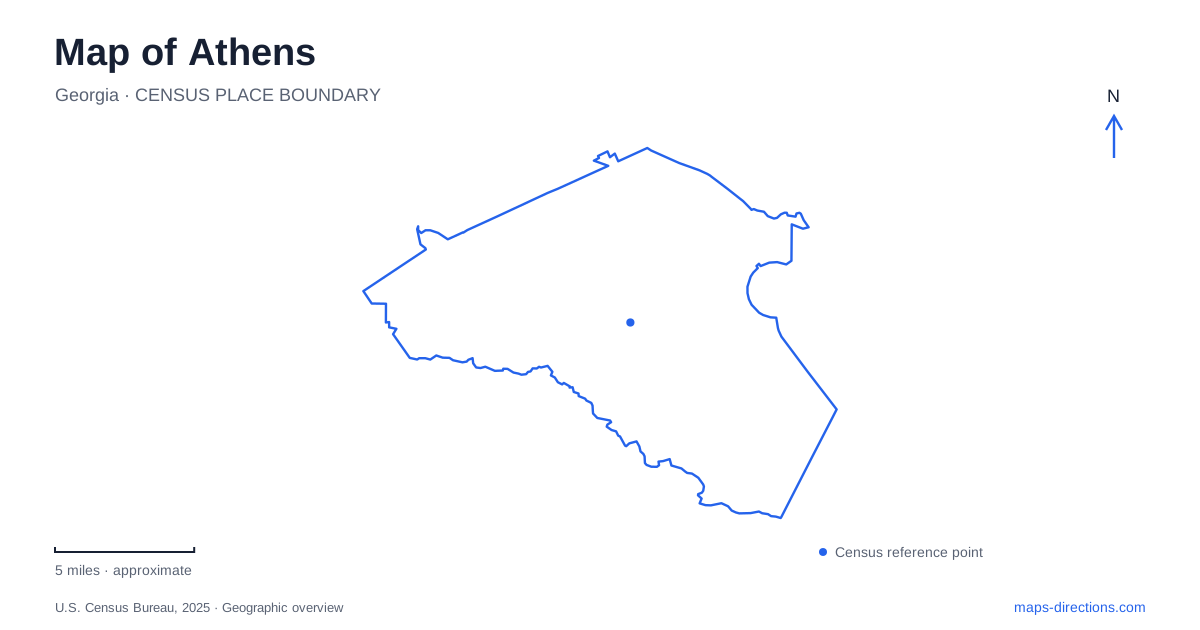
Street tiles load from OpenStreetMap when opened. The blue line shows the 2025 Census boundary.
- State
- Georgia
- Population · July 2025
- 128,612
- Land area
- 116.4 sq mi
- Water area
- 1.8 sq mi
Athens becomes easier to understand when Broad Street is treated as a seam between two kinds of place. Downtown shops and music venues occupy one side; the historic North Campus of the University of Georgia begins across the road. The river corridors and wooded recreation areas add another layer beyond those familiar blocks. A useful map therefore needs more than a university label. It should distinguish the downtown street network, the campus extending away from it, neighborhood commercial centers, and the parks associated with different waterways.
Broad Street and the university edge
Downtown Athens occupies roughly twenty blocks, with Victorian-era buildings accommodating restaurants, shops, and cultural businesses. Broad Street provides a recognizable southern edge to this commercial district because North Campus stands immediately opposite. That relationship makes the street a better starting reference than a broad search for the university, whose destinations are spread over a much larger area. Clayton Street belongs to the downtown shopping geography, while the Arch marks the historic campus approach from Broad Street.
The university's self-guided walking tour begins at that Arch, a cast-iron landmark installed in 1857. Its placement helps explain why a downtown walk and a visit to the oldest campus landscape fit together geographically. It does not mean every university attraction is beside the Arch. The Georgia Museum of Art is on Carlton Street, and the university visitor center is in the Four Towers Building at 405 College Station Road. Those locations create separate points on a campus itinerary rather than interchangeable names for a single arrival place.
There is also a civic welcome center at the corner of Thomas and Dougherty streets. Its location belongs to the downtown network, whereas the university visitor center serves a different part of the map. Keeping these two information stops distinct is particularly useful when a search result says only “visitor center.”
Five Points and the neighborhood corridors
South Lumpkin Street gives a map of Athens a clear line from downtown through the university area toward Five Points. The neighborhood's commercial focus is the meeting of South Lumpkin Street and South Milledge Avenue. Its name describes a recognizable junction rather than a district that should be searched as another downtown. The surrounding neighborhood developed in the 1920s, giving this southern commercial pocket a different setting from the closely packed central blocks.
This creates a useful way to organize local exploration: identify the Broad Street campus edge first, then follow the relationship between South Lumpkin and the Five Points junction. The journey connects several parts of the university setting while leading to a separate neighborhood destination. A restaurant described as being in Five Points should consequently be placed against that intersection, rather than grouped automatically with Clayton Street businesses.
Prince Avenue offers another neighborhood reference, associated with the direction toward Boulevard and Normaltown. Together, the South Lumpkin–Milledge junction and the Prince Avenue corridor show why the local shopping and dining map spreads beyond the central grid. They are distinct geographic clusters with their own approach streets, not merely distant ends of one continuous downtown strip.
The North Oconee landscape
The greenway system introduces a different organizing line to Athens: the river. The North Oconee River Greenway is a concrete, nonmotorized path within a broader system of linear parks and wildlife corridors. Dudley Park and Sandy Creek Nature Center are among the places identified in the county's greenway information. Named components also include the Pulaski Heights, Trail Creek, and Milledge Extension corridors.
These names are useful because they reveal a network with branches and individual sections. A river-oriented outing can be planned around a particular park or trail segment, whereas a downtown outing follows a compact collection of streets. Both appear on the same map, but the useful unit of planning changes. For the greenway, the named segment and its relationship to the water matter more than a general downtown label. The preserved corridor also explains the stretches of open space that interrupt the otherwise developed urban landscape.
Two Sandy Creek destinations
On the northern side of the Athens recreation map, Sandy Creek Nature Center and Sandy Creek Park require separate entries. The nature center is at 205 Old Commerce Road. The park is at 400 Bob Holman Road and includes the Lake Chapman landscape. Their shared creek name can hide this difference when the map is zoomed out.
The county identifies Lakeside Trail and Buckeye Horse Trail among the park's routes. These belong to a lake-and-woodland setting rather than the downtown street environment. The county also explicitly states that the nature center is not accessible through Cook's Trail, so an apparent relationship between the two facilities should not be interpreted as an available through-walk. Choosing either the nature center or the lake park as the destination produces a clearer plan. It also preserves the important distinction between an urban greenway visit, a university walk, and a longer excursion into the wooded recreation landscape.
Map and statistics: U.S. Census Bureau, 2025 Gazetteer, January 2025 generalized place boundaries and Vintage 2025 population estimates. Local references: Visit Athens; University of Georgia; Athens-Clarke County. Article prepared by Maps & Directions.