Map of Arlington Heights
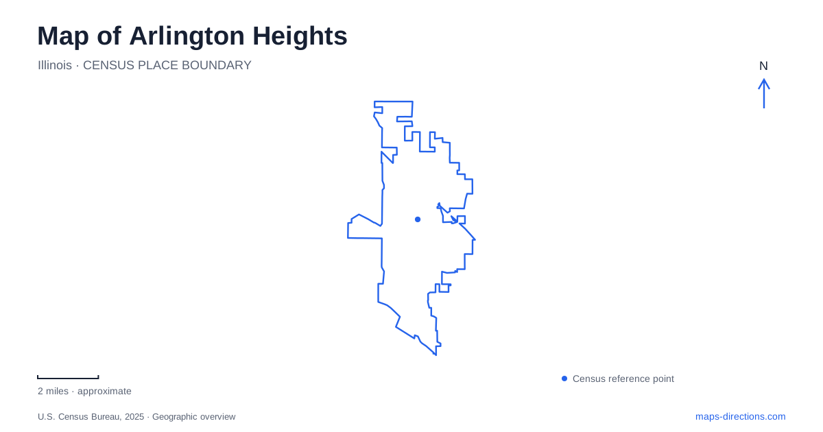
Street tiles load from OpenStreetMap when opened. The blue line shows the 2025 Census boundary.
- State
- Illinois
- Population · July 2025
- 76,216
- Land area
- 16.6 sq mi
- Water area
- 0.0 sq mi
Arlington Heights has a suburban map with a recognizable center: a railroad corridor, a downtown theater, and small streets that support walking between destinations. Beyond that center, its open spaces serve quite different purposes. A formal fountain park, a historic recreation complex, and a stormwater lake are all part of the same community, but they tell different stories about how public land developed. Following those contrasts gives the map more meaning than simply counting green spaces.
Downtown on the rail line
The Union Pacific Northwest corridor passes through downtown, where the Metra station provides a regional arrival point. Metropolis Performing Arts Centre is at 111 West Campbell Street, near Vail Avenue. The venue describes itself as two blocks south of the downtown station, a useful relationship for visitors combining rail travel with an evening performance. Campbell and Vail are therefore good streets to keep visible when moving from a regional railway map to the smaller downtown street grid.
Arlington Park is a second station on the same line, distinct from the central stop. The village's transportation analysis contrasts the downtown station's connections to local streets with Arlington Park's setting near Wilke Road, Northwest Highway, and Route 53. That difference is physical, not merely a naming detail: one arrival places a visitor in the downtown street network, while the other belongs to a more pronounced highway and railway setting. Station selection changes the starting geography of a visit.
A manufacturing story in domestic buildings
The Arlington Heights Historical Museum has its campus on West Fremont, with the main museum address listed as 110 West Fremont and the Heritage Gallery at 112. Its buildings preserve a particularly local connection between family life and soda production. F.W. Müller and his family occupied the Müller House, where soda was originally made in the basement. The nearby coach house accommodated the horses and wagons used for deliveries.
The later soda factory combined bottling machinery, a garage, and apartments for Müller's sons and their families. It now serves as the welcome center and gallery space. The Banta House adds an Arts and Crafts residence designed by Ralph Elliot Abell and built in 1908. Read together, these buildings describe production, transportation, and domestic life on one small campus. The museum is thus more informative as a group of structures than as a single historical marker.
A fountain park and a working recreation park
North School Park is at 307 North Evergreen Avenue. Its central fountain, brick walks, seating, accessible playground, and small performance amphitheater create a formal public gathering space. The park district explains that the land once belonged to village founder Asa Dunton and was designated to remain open for children. Joint acquisition by the district and village in 1988 helped establish the park as a downtown focal point.
A different chapter of Arlington Heights recreation appears at Recreation Park. Its community center was built in 1937 as a Works Progress Administration project and is the district's oldest center. The park combines that building with a pool, baseball facilities, tennis courts, and a skate park. The district distinguishes an inner half-mile walking circuit from a longer perimeter route using sidewalks along Miner, Belmont, Northwest Highway, and Douglas. This is a useful example of how a park route can include ordinary streets as well as paths within its boundary.
Water management made visible
Lake Arlington adds a much larger waterside feature to the Arlington Heights map. The fifty-acre lake was created to manage stormwater and reduce flooding. Its two-mile perimeter path turns that infrastructure into a recreation landscape, while the boathouse, fishing pier, sensory garden, and boardwalk concentrate activities at specific parts of the shore. The lake is therefore both an engineered basin and a place for everyday outdoor use.
The circuit also has a distinctive movement pattern: the park district assigns the outer lane to bicycles and skaters traveling counterclockwise, while pedestrians use the inner lane in either direction. Swimming is prohibited, although seasonal boating is part of the site. These details distinguish a waterside outing here from a beach visit or a trail journey through woodland.
For someone exploring Arlington Heights, the progression from Campbell Street to the Fremont museum campus and then to these parks reveals several layers of the village. The downtown blocks favor short connections between buildings; the museum concentrates a family's industrial history; and the larger recreation spaces expand the scale of movement. Keeping those different settings visible makes it easier to choose a coherent afternoon without flattening every destination into the same kind of suburban stop.
Map and statistics: U.S. Census Bureau, 2025 Gazetteer, January 2025 generalized place boundaries and Vintage 2025 population estimates. Local references: Metropolis Performing Arts Centre; Village of Arlington Heights; Arlington Heights Park District. Article prepared by Maps & Directions.