Map of Arcadia
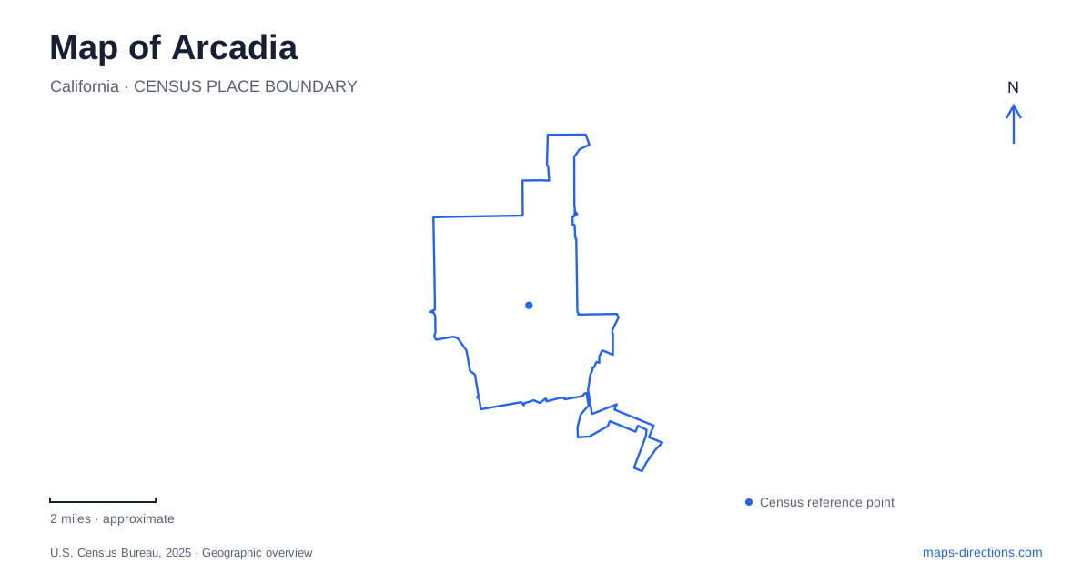
Street tiles load from OpenStreetMap when opened. The blue line shows the 2025 Census boundary.
- State
- California
- Population · July 2025
- 54,117
- Land area
- 10.9 sq mi
- Water area
- 0.2 sq mi
Arcadia combines a downtown rail stop with unusually large garden and racing properties in the San Gabriel Valley. The useful starting distinction is between First Avenue and Santa Clara Street, where the Metro station anchors downtown, and Baldwin Avenue, which serves the Los Angeles County Arboretum and Botanic Garden. Huntington Drive provides another major reference through the city's civic and recreational landscape. These places share a history rooted in Rancho Santa Anita, yet occupy different portions of the modern street map.
Downtown around the operating railway
The Metro station stands at the northwest corner of First Avenue and Santa Clara Street. Older descriptions call its service the Gold Line; current Metro information places it on the A Line. The adjoining parking facilities have a Santa Clara Street address. For a visitor arriving by train, this intersection is a precise starting point for the downtown area rather than an arrival directly at the botanical garden.
Rail travel also belongs to the history of Arcadia. The city's historic-context study describes how Elias Jackson Baldwin secured a railway right-of-way through his subdivided Santa Anita Tract during the nineteenth-century land boom. He supported development with water rights, agricultural improvements, and visitor attractions. The contemporary station thus represents a renewed transportation function in a place whose early settlement and promotion were already closely associated with trains.
Baldwin Avenue and the garden in Arcadia
The arboretum's public address is 301 North Baldwin Avenue, south of the 210 Freeway. Its grounds occupy the heart of the former ranch landscape. The state and county purchased an initial 111 acres, and the foundation incorporated in 1948 to help develop the institution. Later additions brought the garden to 127 acres. This sequence matters because the site is both a botanical collection and a preserved fragment of a much larger landholding.
Baldwin Lake provides an internal geographic focus. The Queen Anne Cottage stands along its shore, while the Reid-Baldwin Adobe and Coach Barn preserve other chapters of the property's history. The cottage was completed in 1885–86 as a guesthouse. Baldwin lived in the adobe, so the ornate building beside the water should not be read simply as his everyday family residence. Following the lake brings these separate structures into a coherent historical setting.
The garden's historic features are embedded within a managed plant collection. Its rules exclude bicycles and recreational equipment from the grounds and do not permit picnics inside. A garden visit therefore involves a different kind of outing from a stop at a general-purpose neighborhood park. The large green area on the map represents a collection with admission and visitor rules, rather than an unrestricted shortcut across the surrounding streets.
Two railway landmarks with different purposes
The Santa Anita Depot within the arboretum is not the Metro boarding point. Built in 1890, it originally served the ranch and nearby Sierra Madre residents, handling passengers and freight with living quarters above for the station agent. Its original location was near today's Colorado Boulevard and Old Ranch Road. Construction of the freeway threatened the old building, leading to a community preservation effort.
The depot was dismantled and reconstructed at the arboretum, with reconstruction completed in 1970. Bricks and surviving architectural elements were reused. That relocation explains why railway history appears inside the garden rather than beside an active platform. Check the arboretum's depot-tour arrangements separately from general garden admission. The preserved building remains an important geographic clue, but its interior tour availability is separate from admission to the larger grounds.
Huntington Drive and Santa Anita landmarks
Santa Anita Park lists its racing venue at 285 West Huntington Drive. Its grandstand, paddock, infield, and event spaces form a substantial destination of their own. The name also carries a difficult wartime history: the grounds served as an assembly center where people of Japanese ancestry were incarcerated in 1942. Recognizing that history gives a fuller account of the place than its racing identity alone.
For local interpretation, the Gilb Museum in Arcadia is at 380 West Huntington Drive. Its collections and programs focus on the city's heritage. The public library is a separate facility at 20 West Duarte Road, despite sharing a municipal website with the museum. South Santa Anita Avenue supplies another recreational reference at the county-operated regional park, whose address is 405 South Santa Anita Avenue.
A useful map of Arcadia consequently has several centers: the operating railway downtown, the lake and historical structures within the arboretum, and the museum and racing grounds along Huntington Drive. Keeping their street relationships visible reveals how ranch development, transport, preservation, and recreation coexist within the present city.
Map and statistics: U.S. Census Bureau, 2025 Gazetteer, January 2025 generalized place boundaries and Vintage 2025 population estimates. Local references: LA Metro; City of Arcadia; Los Angeles County Arboretum; Santa Anita Park; National Park Service; Los Angeles County. Article prepared by Maps & Directions.