Map of Apopka
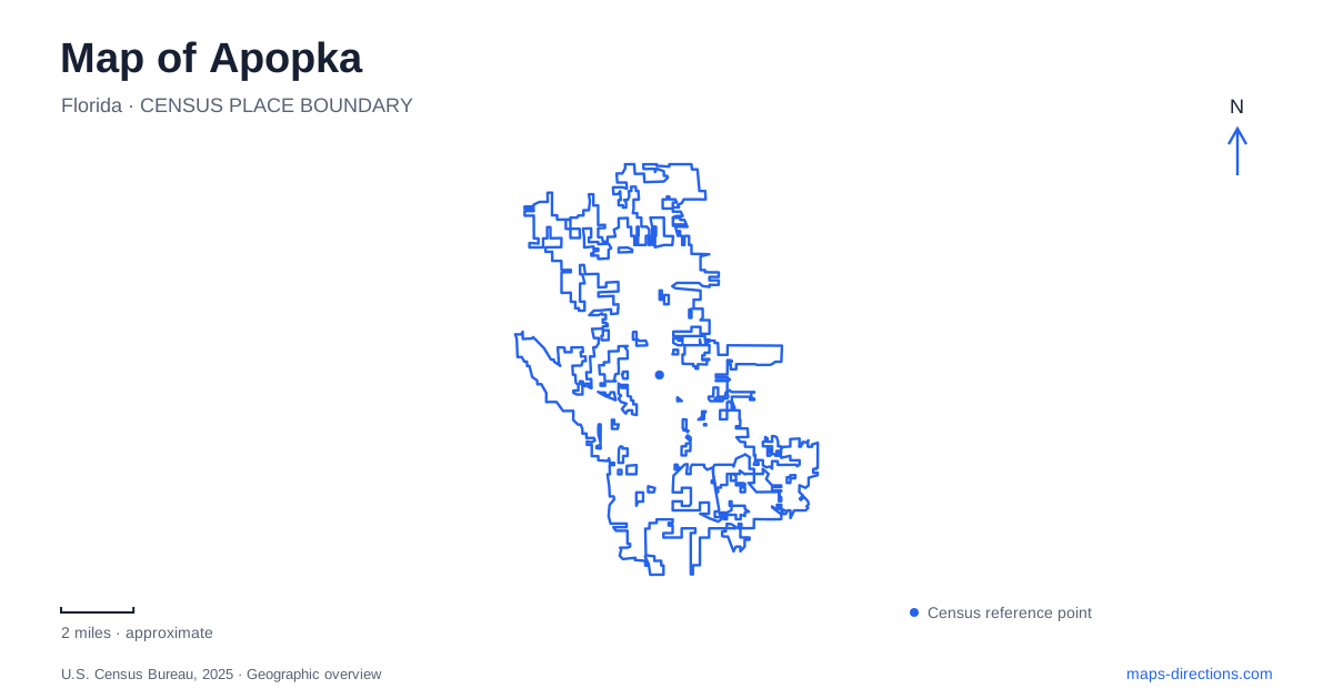
Street tiles load from OpenStreetMap when opened. The blue line shows the 2025 Census boundary.
- State
- Florida
- Population · July 2025
- 65,552
- Land area
- 35.2 sq mi
- Water area
- 1.3 sq mi
Apopka's surroundings tell two connected stories about water and land. Springs supplied recreation and power, while fertile ground supported citrus, ferns and other nursery plants. Large areas beside the lake were later converted from agriculture to wetland restoration. The resulting map contains an established town center, working horticultural landscapes and several distinct conservation properties. Their names can sound similar, but their histories and access arrangements differ substantially.
Foliage growing followed earlier agricultural industries
The local historical society describes a community shaped by crops and transport long before its modern suburban growth. Orange groves expanded around the nineteenth-century settlement, with river and rail connections carrying produce to distant markets. The severe freeze of 1894–95 damaged that economy, although growers subsequently replanted and production recovered.
Commercial fern growing became particularly important during the 1920s. Nurseries then diversified into other foliage plants, producing the identity still associated with Apopka today. This sequence helps explain why agricultural land here cannot be understood simply as former citrus groves. Plant cultivation changed in both products and methods. The city's association with indoor foliage reflects that adaptation rather than one crop remaining dominant throughout its history.
The historic center also contains the local museum at 122 East Fifth Street. It provides a different way to examine these changes, through objects and local records rather than the surviving pattern of fields and nurseries alone.
Community collections became a museum
The historical society's beginnings grew from local efforts to preserve material that residents already held. Edward Miner exhibited early artifacts at a folk festival, and organizers secured rooms in a former school building that had become City Hall. Elizabeth Grossenbacher served as the society's first president and helped bring museum programs into schools.
That origin gives the museum a specific civic role. It did not begin as the preserved estate of a single wealthy household; it developed from a community collection and volunteer organization. For someone studying Apopka on a map, the museum is a useful anchor for the older town, while its collections explain activities that extended far beyond its own address. A small institution can therefore interpret a much wider agricultural and social landscape.
The north shore is an active restoration landscape
Lake Apopka's North Shore includes former agricultural land that is now managed for habitat and water-quality restoration. Much of the area was drained for farming during the early 1940s. Today, wetland management, a marsh flow-way and other projects address the effects of that altered landscape.
The historic pump house is a particularly revealing feature. Equipment once associated with agricultural drainage has also been used to manage water levels in restored wetlands. The visible canals, embankments and wetland cells consequently record both an earlier production system and a later environmental effort. Their engineered appearance is part of the site's history, rather than evidence that the conservation area lacks ecological purpose.
The wildlife drive provides an interpretive route through this landscape. It runs one way for about 11 miles, entering from Lust Road and ending at Jones Road. Those separate endpoints matter: the drive is not a road that can simply be reversed midway, and it is distinct from the wider network of walking and cycling routes.
Kelly Park contains the Rock Springs headwater setting
Kelly Park, at 400 East Kelly Park Road, centers on Rock Springs. Dr. Howard Kelly acquired land around the spring for conservation, and he and his wife donated 200 acres to Orange County in 1927 with the requirement that it remain a public park. Earlier land uses included mills powered by the spring run.
This gives the park a layered history of industry, private conservation and public recreation. Its spring-fed channel is associated with swimming and floating, while the surrounding property also contains camping and trails. Kelly Park should be located by its own name and entrance, particularly because several other nearby destinations use the words Rock Springs. The county park is one specific property within a broader connected water system.
Wekiwa Springs and the state reserve are separate places
Wekiwa Springs State Park includes the spring basin, trails and access to paddling waters. Its history includes logging and ownership by a sportsman's club before state protection. Rock Springs Run forms a boundary between this park and Rock Springs Run State Reserve, which is another separately managed destination.
The reserve's own visitor information directs people seeking swimming and tubing to Kelly Park. Similar waterway names therefore do not make these properties interchangeable. A regional map of Apopka is most useful when it distinguishes the lake restoration area, the county spring park, the state park and the state reserve. Their connections are hydrological and historical, while their entrances, land uses and recreational settings remain distinct.
Map and statistics: U.S. Census Bureau, 2025 Gazetteer, January 2025 generalized place boundaries and Vintage 2025 population estimates. Local references: The Apopka Museum; St. Johns River Water Management District; Orange County Government; Florida State Parks. Article prepared by Maps & Directions.