Map of Annapolis
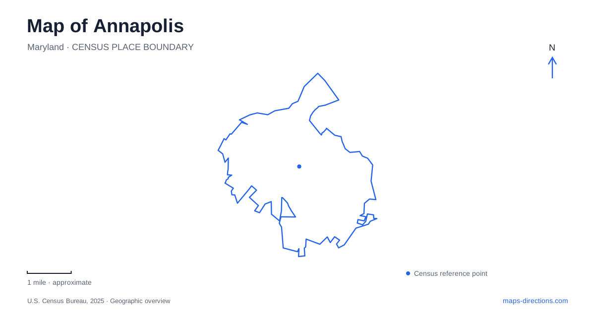
Street tiles load from OpenStreetMap when opened. The blue line shows the 2025 Census boundary.
- State
- Maryland
- Population · July 2025
- 40,634
- Land area
- 7.2 sq mi
- Water area
- 0.9 sq mi
Annapolis has a street pattern that rewards attention to landform. Two circles occupy high ground, streets radiate from them, and Main Street descends toward the harbor. Across Spa Creek, Eastport introduces another waterfront neighborhood, while larger parks occupy different creeks and river shores beyond the historic center. Understanding those relationships helps turn a collection of famous landmarks into a coherent map of Maryland's capital.
Two circles shaped by two hills
Governor Francis Nicholson's late seventeenth-century plan placed the State House on the higher knoll and the church on a slightly lower crest. The circles around them were deliberately different in scale. Streets radiated from these focal points, but the underlying terrain prevented a perfectly symmetrical design.
The city's historic design manual identifies Main Street as following a valley from Church Circle and East Street as following a ridge from State Circle. That distinction explains why the downtown plan does not behave like a regular grid. The street layout combines civic symbolism with the practical shape of the ground.
State Circle and Church Circle consequently serve different roles on a map of Annapolis. One organizes the government precinct; the other centers on St. Anne's Church and the upper end of Main Street. Keeping the two separate makes the surrounding radial streets easier to understand, especially where routes seem to diverge rather than continue straight through.
The Maryland State House also links the local plan to national history. Congress met in its Old Senate Chamber from November 1783 to August 1784. During that period, George Washington resigned his military commission and Congress ratified the Treaty of Paris. The building remains the oldest state capitol in continuous legislative use.
Main Street, City Dock, and West Street
Main Street descends from the church-side high ground to City Dock. The harbor's turning basin, commonly called Ego Alley, gives the waterfront a recognizable shape: boats enter a narrow basin within the developed center rather than simply passing along an open shore. This creates a close relationship between streetside activity and the water.
West Street extends the experience in another direction. The tourism office identifies the Arts District along the corridor between Church Circle and the Westin hotel, with galleries, restaurants, and music venues. The circle therefore acts as a hinge between the downhill route toward the dock and the cultural corridor extending inland.
Maryland Avenue supplies a separate connection from State Circle toward the Naval Academy. Together, these routes reveal the historic center's structure: government above, harbor below, and institutions and commercial streets distributed along different spokes. The circles provide orientation without requiring every destination to fall along one main axis.
Across Spa Creek to Eastport
Eastport lies across the Spa Creek Bridge from downtown. Its Fourth Street business area, boatyards, sailing services, and waterfront businesses reflect a working maritime identity. The bridge also creates a vantage point from which the two sides of the harbor can be understood as adjoining neighborhoods separated by water.
The Annapolis Maritime Museum and Park operates two distinct campuses. The museum address is 723 Second Street, while the Park Campus and education center occupy 7300 Edgewood Road. They share an organization and a maritime focus, but the park address leads to a different waterfront setting.
At the 12-acre Park Campus, a restored waterworks building houses educational space. More than a mile of clamshell trails overlooks Back Creek, and a public paddle-craft launch provides access for kayaks and canoes. The Merrill Family Pavilion stands among the trails and historic building. This combination of former utility infrastructure, education, and creek-side landscape broadens the maritime story beyond the downtown harbor.
Quiet Waters between two waterways
Quiet Waters Park occupies 340 acres between the South River and Harness Creek, with its entrance at 600 Quiet Waters Park Road. Its wooded paved trails, playgrounds, and picnic areas offer a much larger park setting than the compact waterfront spaces near City Dock.
On an Annapolis-area map, the names of these waterways matter. Spa Creek organizes the downtown–Eastport relationship; Back Creek frames the maritime Park Campus; Harness Creek and the South River define Quiet Waters. Treating all four as interchangeable waterfront labels would conceal the city's peninsula-like geography and the separate approaches to each destination.
A day centered on the circles and Main Street will therefore have a different spatial rhythm from one focused on the creek parks. The former follows a compact civic and commercial plan; the latter explores wooded shores and maritime facilities across a broader area. Both belong to the story of Annapolis, where the relationship between land and water remains visible at every scale.
Map and statistics: U.S. Census Bureau, 2025 Gazetteer, January 2025 generalized place boundaries and Vintage 2025 population estimates. Local references: City of Annapolis; Maryland State Archives; Visit Annapolis; Annapolis Maritime Museum and Park; Anne Arundel County. Article prepared by Maps & Directions.