Map of Anchorage
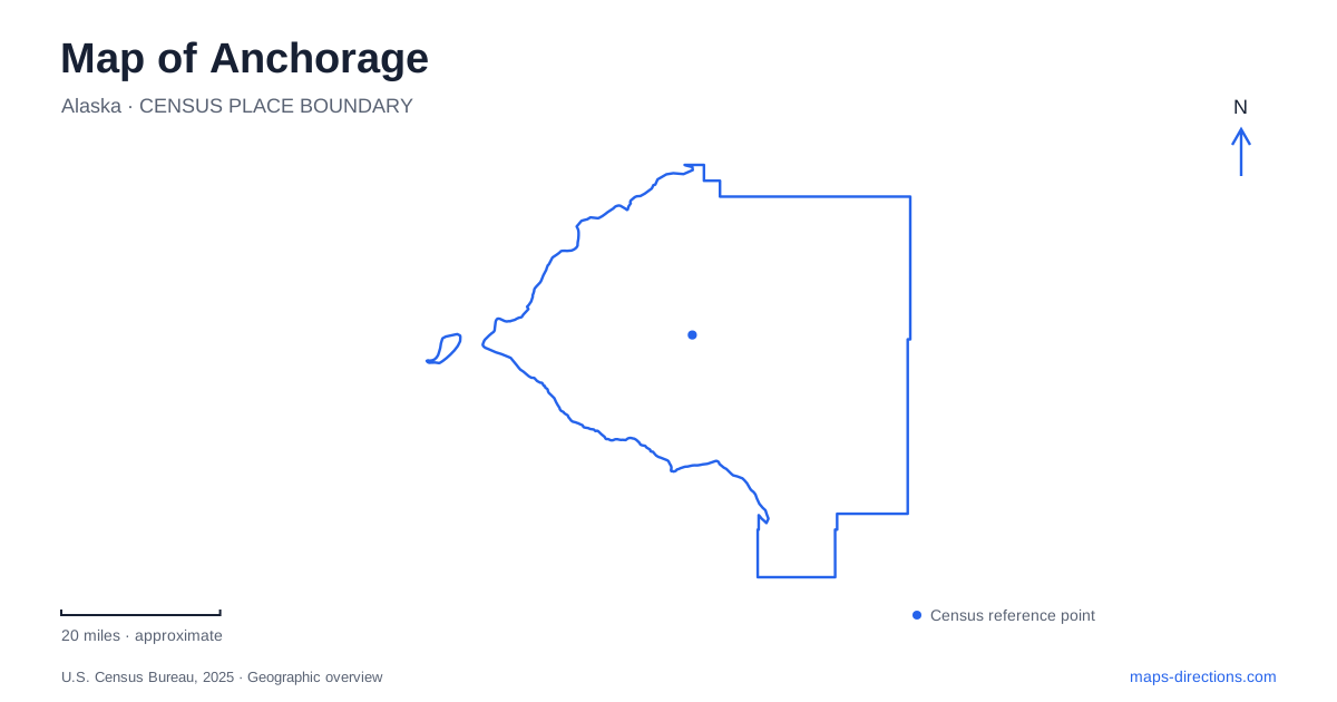
Street tiles load from OpenStreetMap when opened. The blue line shows the 2025 Census boundary.
- State
- Alaska
- Population · July 2025
- 287,155
- Land area
- 1,706.8 sq mi
- Water area
- 237.7 sq mi
Anchorage occupies a setting where coastal lowlands, creek corridors and mountain slopes create very different kinds of journeys. The downtown streets and railway area provide one frame of reference, while Cook Inlet and the Chugach landscape provide another. A useful map distinguishes a paved coastal outing from a mountain ascent and recognizes that a highway following the shore is not the same route as a recreational trail. Local history adds further depth: the modern city developed within a much older Indigenous homeland.
Ship Creek and the longer history of the land
The area lies within Dena'ina Ełnena, the homeland of the Dena'ina Athabascan people. Place names preserve knowledge about geography and cultural use that predates the modern street system. Point Woronzof, for example, is associated with the name Nuch'ishtunt, referring to protection from wind. Indigenous place-name markers along parks and trails make some of that knowledge visible within present-day public spaces.
Railroad construction brought a major transformation in 1915, when a tent community developed along Ship Creek. That episode is central to the story of modern Anchorage, but it should not be mistaken for the beginning of human life in the area. The creek and harbor landscape had existing cultural importance before the rail project. Reading both histories together provides a fuller understanding of the downtown setting than a chronology beginning only with construction workers and surveyed streets.
Following Cook Inlet on the coastal trail
The Tony Knowles Coastal Trail runs about eleven miles from downtown to Kincaid Park. Its paved route follows the Cook Inlet shore through marshes and wooded terrain, passing Westchester Lagoon, Earthquake Park and Point Woronzof. The shoreline alignment produces a different experience from traveling across the city by road: changing views, vegetation and coastal landforms become the organizing features.
The full return journey is roughly twice the one-way distance, so the eleven-mile description should not be read as a complete out-and-back outing. Shorter sections can provide a meaningful coastal walk without covering the entire route. There are rolling elevation changes, including more substantial hills near Point Woronzof and the approach to Kincaid. The trail's pavement does not mean that its whole length is flat. Earthquake Park also records the dramatic ground changes associated with the 1964 earthquake, placing a major geological event directly within the recreational landscape of Anchorage.
Potter Marsh and the southern road corridor
Potter Marsh lies beside the Seward Highway near its junction with East 154th Avenue, at milepost 117. It forms the southern end of the coastal wildlife refuge and provides elevated boardwalk access to wetlands. Channels, open water and sedges support waterfowl and other wildlife, while Rabbit Creek passes beneath part of the boardwalk.
This is a place to observe the relationship between freshwater, wetland vegetation and the nearby coastal environment. Salmon return through the creeks, and the marsh supports birds ranging from ducks and grebes to terns and raptors. The boardwalk concentrates human access without requiring visitors to walk through sensitive habitat. It is also a practical way to distinguish a marsh visit from an excursion onto the tidal flats, where incoming water and sticky mud create serious hazards.
The Seward Highway continues along Turnagain Arm, linking the southern edge of Anchorage with places such as Beluga Point, Bird Creek and Girdwood. Those destinations belong to a longer coastal road corridor. Combining them with Potter Marsh creates a different itinerary from following the urban coastal trail toward Kincaid, even though both outings involve views of inlet waters.
Glen Alps offers several levels of mountain access
Glen Alps is a gateway to Chugach State Park through the Hillside road network. The state describes an approach using O'Malley Road, Hillside Drive, Upper Huffman and Toilsome Road. At the trailhead, options vary considerably in effort and terrain. The short overlook loop is approximately a quarter mile, with a viewing deck and a small elevation change.
Flattop Mountain is a much more demanding choice from the same general access area. The state trail guide lists about a mile and a half each way and roughly 1,300 feet of elevation gain, including steep ground and scrambling. Sharing a trailhead does not make these two routes equivalent. Their contrast is particularly useful when reading a mountain map: the destination's position, elevation and terrain matter as much as the distance drawn on the page.
A city understood through its edges
The geography of Anchorage becomes clearer when Ship Creek, the inlet shore, the southern marsh and the mountain trailheads are treated as distinct settings. Each has its own history and pattern of movement. Indigenous place names, railroad development, earthquake-altered ground and living wetlands are all part of that picture. The result is a city whose map can be read through water and terrain as well as through its built streets.
Map and statistics: U.S. Census Bureau, 2025 Gazetteer, January 2025 generalized place boundaries and Vintage 2025 population estimates. Local references: Visit Anchorage; Alaska Railroad; Alaska Department of Fish and Game; Alaska State Parks. Article prepared by Maps & Directions.