Map of Anaheim
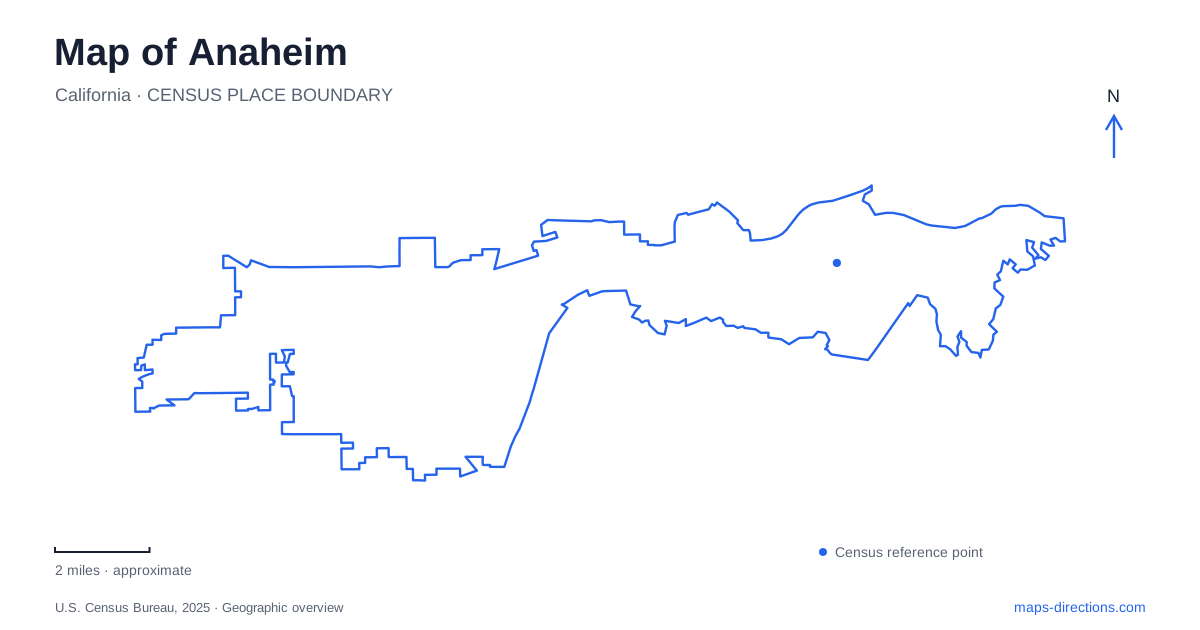
Street tiles load from OpenStreetMap when opened. The blue line shows the 2025 Census boundary.
- State
- California
- Population · July 2025
- 341,008
- Land area
- 50.3 sq mi
- Water area
- 0.6 sq mi
Anaheim's map tells a longer story than its theme parks alone suggest. The original colony survives in a recognizable street rectangle, former agricultural buildings anchor a modern dining district, and major entertainment venues occupy another part of the urban landscape. Farther east, oak woodland and canyons change the terrain entirely. Understanding these layers helps explain why the city's historic center, resort area, sports destinations, and nature trails each have their own geographical focus.
Four street names preserve the original colony
North, South, East, and West streets mark the boundaries of the original German colony founded in 1857. They also define the later Colony Historic District, adopted in 1997. The district's approximately 1.8 square miles contain more than a thousand qualifying historic structures, according to the city. This is a neighborhood-scale historic landscape, not simply a single preserved building surrounded by newer development.
Monuments mark principal approaches at North and South streets along Anaheim Boulevard, and at East and West streets along Lincoln Avenue. Those intersections provide a particularly clear way to read the old settlement on a present-day street map. The directional street names describe the colony's historical edges rather than the limits of the much larger contemporary city. Once that distinction is understood, the arrangement of the downtown district becomes easier to interpret.
Houses, vineyards, and the citrus landscape
Founders' Park sits on the western boundary of the old colony at 400 North West Street. The approximately one-acre site contains the 1857 Mother Colony House and the Queen Anne-style Woelke-Stoffel House from the citrus era. A heritage Moreton Bay fig, orange grove, windmill, and pump house give the grounds a landscape as well as an architectural character.
The early settlement depended on vineyards. Disease devastated the vines during the 1880s, and citrus groves subsequently took their place. The park's water-related exhibits help explain the agricultural transition: successful cultivation depended on irrigation and working infrastructure, not only suitable weather. The Mother Colony House itself was moved to the current site in 1928. Its presence therefore preserves an early building without implying that every element of the park occupies its original nineteenth-century position.
Packing buildings become a dining district
The Packing House occupies a former orange-packaging facility built in 1919. Its reuse as a two-story food hall allows the large agricultural building to remain part of daily urban activity. The wider Packing District includes the MAKE building, Farmers Park, and the Packard Building. Seeing these as a group makes the area's historical continuity clearer than looking for a single restaurant marker.
The MAKE building has its own citrus-processing story. Work began on a marmalade factory in 1916 at the southeast corner of what was then South Los Angeles Street and Santa Ana Street. The factory's unsuccessful operation ended in 1920, and the building later served other uses. South Los Angeles Street became Anaheim Boulevard, so historical descriptions and modern directions use different names for the same corridor. That change is useful to recognize when comparing older maps with today's downtown streets.
Center Street Promenade adds a different downtown setting, with public art and local businesses along a pedestrian-oriented commercial corridor. The Muzeo Museum and Cultural Center provides a cultural reference at one end. Together, the promenade and reused packing buildings show how shopping, dining, and civic culture extend the life of the old center.
Katella Avenue and the larger visitor destinations
Katella Avenue connects the map's vocabulary of convention, transportation, and sports facilities. The convention center is listed at 800 West Katella Avenue, while ARTIC occupies 2626 East Katella Avenue and Honda Center stands at 2695 East Katella Avenue. Angel Stadium uses Gene Autry Way as its address. The east and west prefixes matter here because the same avenue name appears across several different destinations.
Honda Center lies east of State Route 57 and west of the Santa Ana River. Those two strong linear features help locate the arena within the larger region. ARTIC adds rail and other transportation functions to this part of Anaheim, while the resort has its own arrival arrangements. Disney identifies separate guest pickup and drop-off approaches from Harbor Boulevard and through the Downtown Disney side. These details make the choice of arrival point more informative than simply selecting the overall resort label.
Three canyons in the eastern hills
Oak Canyon Nature Center occupies 58 acres at 6700 East Walnut Canyon Road. Three adjoining canyons contain roughly four miles of trails, a year-round stream, oak woodland, and coastal sage scrub. The John J. Collier Interpretive Center presents regional natural history on the same site.
This landscape adds a terrain-based dimension to a map otherwise dominated by streets and major venues. The stream and adjoining canyons explain the trail pattern, while the woodland preserves habitat quite different from the colony's cultivated agricultural past. Including the eastern hills makes Anaheim's range of settings visible: historic settlement, reused industry, regional entertainment infrastructure, and surviving natural corridors all contribute to its geography.
Map and statistics: U.S. Census Bureau, 2025 Gazetteer, January 2025 generalized place boundaries and Vintage 2025 population estimates. Local references: City of Anaheim; Anaheim Packing District; Visit Anaheim; Disneyland Resort. Article prepared by Maps & Directions.