Map of American Fork
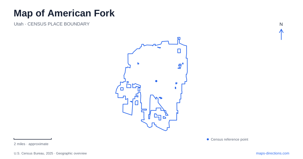
Street tiles load from OpenStreetMap when opened. The blue line shows the 2025 Census boundary.
- State
- Utah
- Population · July 2025
- 41,020
- Land area
- 11.4 sq mi
- Water area
- 0.0 sq mi
American Fork occupies a setting where the historic street grid, Utah Lake shoreline, and routes toward the Wasatch Mountains serve very different purposes. Downtown landmarks explain the early settlement, northern recreation grounds provide fields and trail access, and the boat harbor faces the lake. The nearby canyon is part of a wider mountain trip, with its own highway approach and seasonal road considerations.
Main Street and the former Lake City Fort
Robinson Park stands at the southwest corner of Main Street and 100 East. The city's self-guided historic walking tour begins and ends here, making the park a useful anchor for exploring older downtown buildings. Its Fort Wall Memorial marks the location of the southern wall of the 1853 Lake City Fort.
The monument includes a statue representing Edward Robinson. A bell formerly displayed on its pedestal was moved to the bell tower of the restored City Hall. That small relocation is a reminder that historical objects and their original sites do not always remain together. The park also contains a Daughters of Utah Pioneers Museum with early community artifacts.
The earlier name Lake City belongs to the settlement's history, while the present name comes from the river. The city was settled in 1850 and incorporated in 1853. On a map of American Fork, the fort memorial and Main Street provide concrete reference points for those early years rather than leaving them as dates detached from the landscape.
A northern park with two names in circulation
Mary and Art Dye Park is at 550 East 1000 North. Some municipal listings still use the shorter Art Dye name, but the City Council approved the expanded name in May 2025 to recognize Mary as well as Art. The two labels identify the same recreation grounds.
The park's municipal inventory includes baseball fields with a scoring tower, soccer fields, pickleball courts, playgrounds, and trails. Its northern street-grid location makes it a separate destination from Robinson Park and the older Main Street blocks. This is a broad active-recreation setting rather than a compact historical square.
The city also identifies access to the river trailhead, while a later municipal newsletter references the Murdock Canal Trail among the park's accessible amenities. Those connections make the grounds useful for more than field sports. A trail visit and an organized game can begin in the same general park while using different parts of its layout.
The Utah Lake shoreline
The American Fork Beach and Boat Harbor is at 1730 South 100 West. Its position in the southern street grid takes a visitor toward Utah Lake, away from the northern sports fields. The published address is especially useful because the water itself is a much larger regional feature than this one city-operated access point.
The city's capital-project record lists completion of harbor parking and amenity improvements in June 2025. The harbor page describes shoreline protection, improved fishing access, a playground, seating, an expanded beach area, and a wide trail among the work. The result is a shoreline destination that includes land-based recreation as well as launching boats.
That range of uses matters when reading a harbor symbol. It does not represent only a ramp, and the beach and public amenities do not cover the whole lake shore. The site is one defined piece of a much broader waterscape, with its own entrance and circulation.
The mountain approach is a separate journey
American Fork Canyon leads toward Timpanogos Cave National Monument, but a canyon destination should be planned with the National Park Service's road directions. From Interstate 15, the agency directs drivers to Exit 284, then east on State Highway 92 toward the monument. The visitor center is along that canyon highway, not within the downtown grid.
The Alpine Scenic Loop offers an alternative approach from the Provo Canyon side. The National Park Service describes it as narrow and winding, closed in winter, and unsuitable for vehicles over thirty feet. This makes the loop a particular mountain route with limitations rather than an interchangeable shortcut. The agency also notes that no public transportation serves the monument.
The difference between lake and mountain travel is one of the most useful features of an American Fork map. South 100 West leads toward a defined shoreline facility; the downtown numbered streets frame the historic core; the northern grid reaches a large recreation park; and Highway 92 approaches the canyon landscape beyond. Keeping those settings distinct makes the city's varied destinations easier to understand before selecting a route.
Map and statistics: U.S. Census Bureau, 2025 Gazetteer, January 2025 generalized place boundaries and Vintage 2025 population estimates. Local references: City of American Fork; National Park Service. Article prepared by Maps & Directions.