Map of Allen
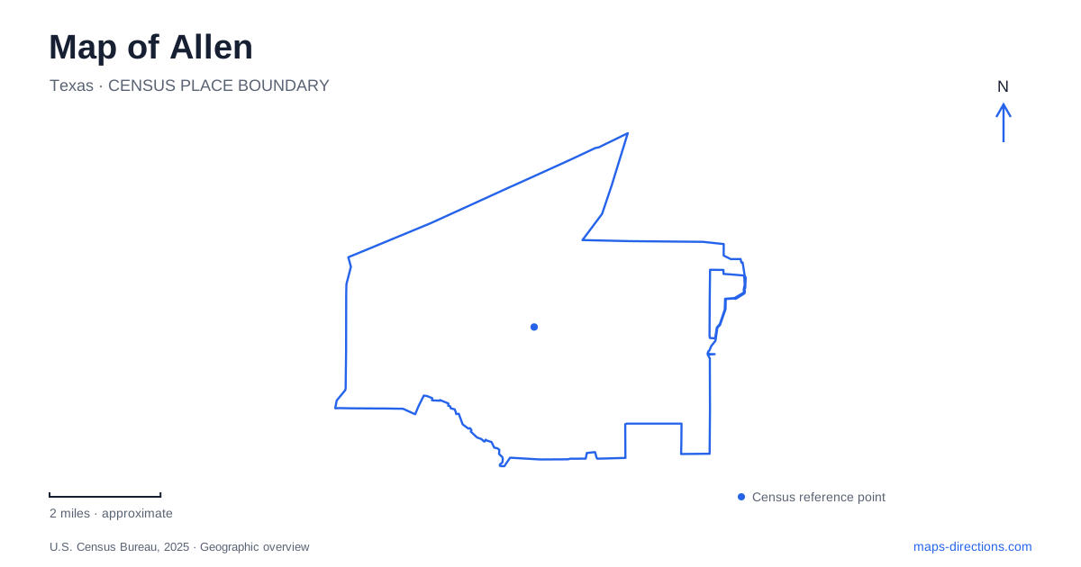
Street tiles load from OpenStreetMap when opened. The blue line shows the 2025 Census boundary.
- State
- Texas
- Population · July 2025
- 113,447
- Land area
- 26.4 sq mi
- Water area
- 0.1 sq mi
Allen's map reflects two eras of regional travel: the railway that helped establish the settlement and US 75, which now provides a major route through the city. Creek corridors add another pattern, carrying trails through residential areas and past historic infrastructure. Locating the depot, Old Stone Dam, Heritage Village, Watters Creek Village, and the Stacy Road arena reveals how these different lines of movement relate to the modern street network.
The highway divide and the older railway town
The city's trails and bikeways plan describes US 75 as both a regional connection and an east–west divide. It places the municipality in southwestern Collin County, with Plano to the south and west, McKinney to the north, Fairview to the northeast, and Lucas and Parker toward the southeast. This regional frame is useful when approaching from another part of the Dallas area, but it does not explain the older town by itself.
Railroad development supplied that earlier structure. A water station on Cottonwood Creek supported steam locomotives, and a village plat followed in 1876. Agriculture, railway movement, and the need to replenish engines with water helped determine where activity concentrated. The city incorporated much later, in 1953. On a map of Allen, the railway landmarks therefore record a settlement pattern that predates the broad suburban highway landscape.
The depot and the village preserve different things
The depot museum is at 100 East Main Street. Its permanent exhibits include the Houston and Texas Central Railroad, the station master's office, the interurban, the telephone exchange, and early settlement. These subjects make the depot a useful place to examine how transport and communications connected local residents with a larger region. East Main Street supplies a concrete address for that historical core.
Heritage Village occupies several acres at 450 East St. Mary Drive in the old residential area. The site brings together relocated and restored homes, outbuildings, and churches. Because those structures were assembled from different locations, the village should be understood as a preservation landscape rather than an untouched block of buildings standing exactly where they originated.
The collection includes examples of domestic forms that are less visible in newer subdivisions. The heritage driving guide describes an I-house associated with the late frontier period and early twentieth-century bungalows, alongside a church with historic stained glass. A visit thus shifts attention from the transport exhibits at the depot to the rooms, construction forms, and community buildings of daily life. Allen's early history becomes easier to read when both sites are plotted, instead of using one as a substitute for the other.
Cottonwood Creek and the locomotive water supply
The Old Stone Dam was built in 1874 to help provide water for steam locomotives on the Houston and Texas Central Railway. Its creek setting explains the choice of location: railway operations depended on water as well as rails. The structure is a practical piece of industrial history embedded in what is now also a recreation corridor.
Cottonwood Trail follows the creek from the Ridgeview Drive area and passes beneath US 75 before reaching the dam and the station park area. This underpass is an important connection between the highway's two sides. The park combines the historical setting with athletic fields, a playground, skate facilities, a BMX track, and roller hockey rinks. Following the trail gives the dam a landscape context that a single landmark marker cannot show.
Two places with the Watters Creek name
Watters Creek Village is a shopping and dining destination at 970 Garden Park Drive. Watters Trail also connects residential and wooded creek settings with this mixed-use area. This offers a different kind of outing from the railway history corridor: a trail segment can form part of a visit to shops or restaurants, with the creek providing continuity through the development.
The Courses at Watters Creek is a separate golf destination. Its facilities include the eighteen-hole Traditions Course, nine-hole Players Course, and six-hole Futures Course. The shared creek name can make search results look interchangeable, but a retail visit and a golf booking point to different facilities. Keeping the full destination name in the itinerary is particularly useful in Allen, where the creek's name identifies several kinds of places.
Stacy Road's larger event destination
The Credit Union of Texas Event Center stands at 200 East Stacy Road, Suite 1350, near US 75. Its arena hosts concerts, sports, exhibitions, and other large gatherings, with nearby restaurants, hotels, and shopping. The venue identifies its south parking garage as an arrival option, adding an internal reference beyond the street address.
Stacy Road, East Main Street, East St. Mary Drive, and Garden Park Drive organize four distinct destinations on an Allen map. The creek trails connect some outdoor experiences, while the highway serves the larger regional approach. Reading both systems preserves the relationship between the original railway settlement and the city's later commercial growth.
Map and statistics: U.S. Census Bureau, 2025 Gazetteer, January 2025 generalized place boundaries and Vintage 2025 population estimates. Local references: City of Allen; City community calendar; Allen Heritage Guild; Visit Allen; Watters Creek Village; Credit Union of Texas Event Center. Article prepared by Maps & Directions.