Map of Alexandria
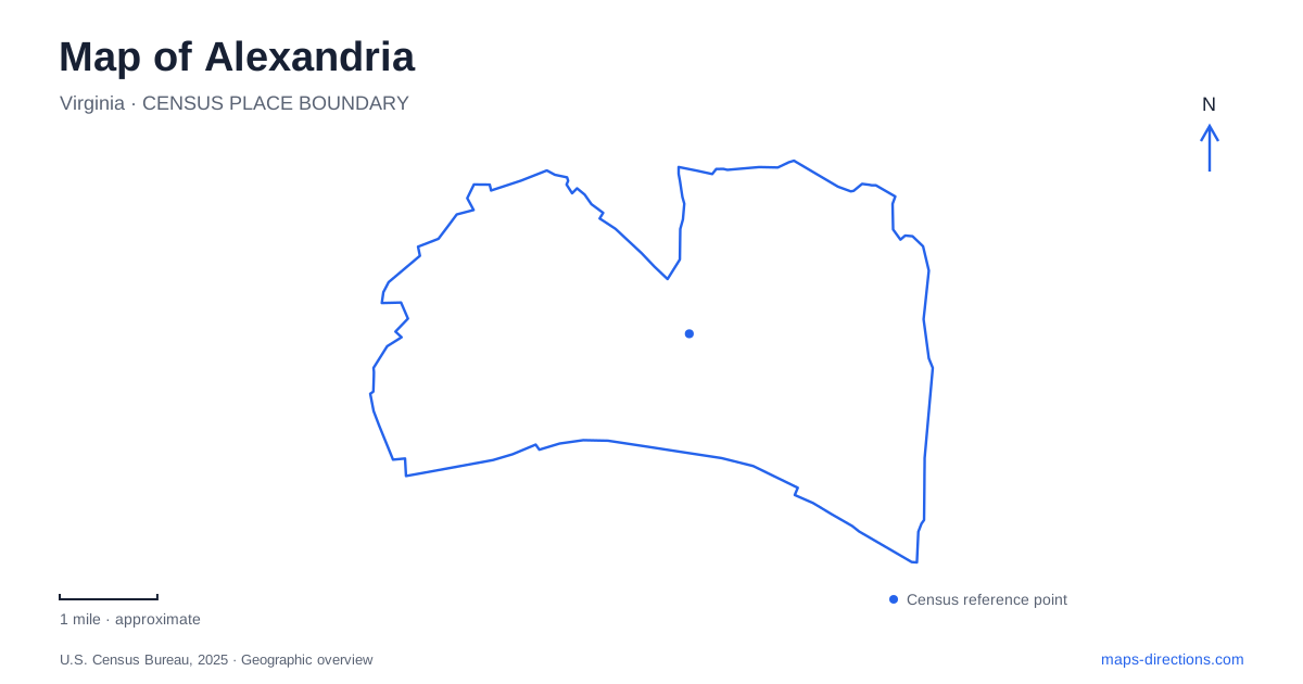
Street tiles load from OpenStreetMap when opened. The blue line shows the 2025 Census boundary.
- State
- Virginia
- Population · July 2025
- 160,662
- Land area
- 14.9 sq mi
- Water area
- 0.4 sq mi
Alexandria’s map records a city that repeatedly remade its relationship with transportation. Along the Potomac, wharves and landfill extended the shoreline. Farther north, a vast freight yard reorganized rail traffic, while streetcars encouraged new residential communities. These different histories remain visible in the contrast between Old Town's waterfront blocks, Del Ray's long neighborhood streets, and the larger redevelopment parcels of Potomac Yard. The river supplies a common reference, but it does not explain every district in the same way.
The waterfront stands on constructed land
The modern shoreline is not the shoreline of the town founded in 1749. Merchants built wharves into the Potomac and filled the spaces between them, gradually creating land for roads, warehouses, and commercial activity. Union Street and the Strand emerged through this process. The area around lower King Street east of Lee Street occupies land made as the waterfront advanced into the river.
This history changes how the waterfront is understood. A present-day street parallel to the river may cross what was once water, and an archaeological discovery beneath a building can belong to an earlier harbor landscape. The slight rise looking west along King Street recalls the position of the original bank. Alexandria’s waterfront is therefore both a preserved historic district and the product of substantial physical alteration.
At North Union Street, the Torpedo Factory adds a twentieth-century industrial layer. Its earliest section was completed in 1919 for naval production, after the First World War had ended. The complex later served federal storage functions before becoming an art center in 1974. Its galleries and studios occupy a place whose earlier purposes were tied to manufacturing and government logistics, extending the waterfront's history beyond its eighteenth-century port image.
Jones Point and the southern river edge
Jones Point Park lies just south of Old Town, beneath and beside the Woodrow Wilson Bridge. Its interpretive trail connects a landscape of recreation fields, marsh habitat, and remnants of maritime activity. The lighthouse is the most visible historical structure, but the point also contains evidence of shipbuilding and earlier uses of the riverbank.
The lighthouse's beacon first operated in 1856. Its compact design combined the keeper's dwelling and light in one building, providing guidance to vessels negotiating the Potomac's shoals. An automated tower replaced its navigational role in 1926 after changes to the shoreline and surrounding industry. Today the exterior remains a landmark, while the lighthouse itself is not generally open inside.
Near it, the south cornerstone associated with the original survey of Washington, D.C., introduces another geographical story: the definition of a national capital. A visit to this part of Alexandria consequently brings river navigation and political boundaries into the same small landscape. The bridge overhead is only the latest large transportation structure to influence the point.
Del Ray’s long blocks and streetcar origins
Del Ray and St. Elmo developed north of the nineteenth-century city limits as planned neighborhoods served by a light railway. Their long-block grids reflect a residential expansion associated with commuting rather than the wharf economy of Old Town. Mount Vernon Avenue is the main commercial street through Del Ray and neighboring Arlandria, giving this northern area a clear local axis.
In 1908, Del Ray and St. Elmo formed the incorporated Town of Potomac, with their own municipal services. Annexation in 1930 brought that town into Alexandria. Those dates help explain why neighborhood identity and the present city boundary do not tell the same historical story. Del Ray was once part of a separate municipality, not simply a later marketing name for an Old Town extension.
The former electric railway also connected the districts through a specific route: from the south it traveled into town, reached King Street, then continued toward Commonwealth Avenue and north across Four Mile Run. That sequence reveals a transport geography extending beyond today's most familiar visitor waterfront.
Potomac Yard’s change of scale
East of the older northern neighborhoods, Potomac Yard developed as a freight-classification facility along Route 1 north of Slaters Lane. Here, incoming trains were broken into groups of cars and reassembled according to their onward destinations. Its significance lay in coordinating several railroads, making the site a regional interchange rather than merely a local station.
Homes and businesses have since replaced much of the yard landscape, and the Metro station opened in 2023. Heritage signs along Potomac Avenue explain the former operation, including the role of the sorting hump. This redevelopment occupies a scale of land quite different from the small waterfront lots and residential streetcar blocks.
Reading these places together gives Alexandria a layered geography. Made shoreline supported the port, the streetcar grid supported residential commuting, and the freight yard organized regional goods movement. The surviving streets, reused industrial buildings, and newer transit facilities make those successive systems legible within the present city.
Map and statistics: U.S. Census Bureau, 2025 Gazetteer, January 2025 generalized place boundaries and Vintage 2025 population estimates. Local references: City of Alexandria; National Park Service. Article prepared by Maps & Directions.