Map of Alaska
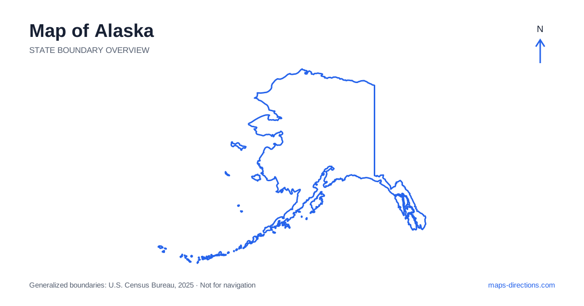
Alaska cannot be understood as a larger version of a typical road-trip state. Its landmass includes a road-connected interior, a long southeastern coastal strip, an extensive western coastline and the Aleutian island chain. Many communities have no road connection to the main highway system. A useful map therefore starts with a different question: which places can be joined by road, and which require another form of transport? Anchorage, Fairbanks and Juneau are essential reference points, but they do not represent three interchangeable stops on a continuous driving loop.
Keep the full geographical scale in view
A map of this far northern state often appears as an inset beside the contiguous states. That presentation saves space but can hide both its scale and its position. The mainland lies northwest of Canada, with the Arctic Ocean to the north and the Pacific-facing coast to the south. The Aleutian chain extends far into the North Pacific, making a full boundary view much wider than a map focused only on the main road network.
The outline here keeps the geographic pieces together rather than shifting them into a decorative mainland inset. Even so, a statewide overview is not suitable for comparing local travel times. Zoom into the relevant region before selecting accommodation or connecting transport. A pair of names that fit comfortably beside one another on the overview can represent an entirely separate stage of a journey.
Distinguish the main urban reference points
Anchorage sits beside Cook Inlet in the south-central region and is a major starting point for trips into the surrounding road network. Fairbanks is inland, north of the Alaska Range, and serves a different geographical area. The Parks Highway connects the two cities through the interior corridor, while other routes form connections through places such as Palmer, Glennallen and Delta Junction. Mountains and river valleys shape these routes rather than a regular street-like grid.
Juneau, the state capital, lies in the southeastern panhandle and is not connected by road to Anchorage or the continental highway network. Treating it as a simple detour from an interior drive would produce an unusable itinerary. Place coastal and interior visits on separate planning layers, with the transport connection between them made explicit before assigning dates or counting driving days.
Use mountain ranges to explain the road network
Across the mainland, the major ranges are practical orientation features, not simply scenic labels. The Alaska Range separates parts of the south-central region from the interior, while the Brooks Range stretches across the north. On a terrain map, these broad barriers help explain why the road system has comparatively few long-distance corridors and why a route may make a substantial bend instead of pointing directly toward its destination.
The Dalton Highway extends north from the interior toward the Arctic coast, but it should not be interpreted as an ordinary extension of an urban sightseeing drive. Its remoteness, services and operating conditions require a separate plan. Likewise, a line shown through mountain country does not establish that every vehicle, rental agreement or season is suitable. The map identifies a corridor; the practical requirements must be checked for the intended journey.
Read the southern peninsulas and coastal inlets
The Kenai Peninsula projects southwest from the Anchorage region and contains destinations with very different coastal orientations. Seward faces Resurrection Bay, while Homer lies beside Kachemak Bay on the peninsula's western side. These places may both be described as south-central coastal destinations, yet they are reached along different branches of the road network. Organize a visit around those branches rather than expecting one coastal road to connect every waterfront town.
Farther east, Prince William Sound contains islands, inlets and communities separated by water and mountains. A straight-line measurement across the sound says little about an actual transfer. The same principle applies along the southeastern coast, where channels and islands strongly influence transport. On a detailed map, look for terminals and arrival points as carefully as you would look for highway junctions on a mainland driving route.
Avoid treating every settlement as road accessible
Across western and northern Alaska, many settlements rely on air travel, marine access or locally specific transport arrangements rather than roads linked to Anchorage. A map may display a town label without showing how visitors normally reach it. The absence of a highway is meaningful information, not necessarily a missing detail that will appear when the view is enlarged.
Start with the transport network that actually serves the place, then map the local stay around its arrival point. Do not join remote destinations with a drawn line and label the result a road itinerary. This is especially important when comparing a coastal community with an interior park visit: the experiences may fit the same broad trip theme while requiring completely different bookings, equipment and time allowances.
Plan by connected travel areas
An effective overview separates a south-central road trip, an interior journey and a southeastern coastal visit before considering whether to combine them. Within each area, identify the main base, the farthest planned excursion and the route back. For an out-and-back road, the return leg is part of the trip even when the overview makes it look like a single thin line.
A realistic Alaska map plan also leaves room for transport disruption and changing conditions without pretending to predict them. Record the departure point, arrival point and travel mode for every regional transfer. Keep local destination maps available separately from the statewide outline. The result is a sequence of connected, understandable stages rather than a list of distant place names that only appear close because they share the same page.