Map of Akron
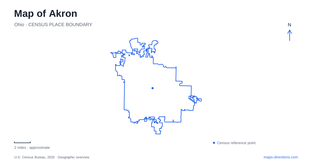
Street tiles load from OpenStreetMap when opened. The blue line shows the 2025 Census boundary.
- State
- Ohio
- Population · July 2025
- 189,691
- Land area
- 61.9 sq mi
- Water area
- 0.3 sq mi
Akron's map makes more sense when the canal corridor is treated as a foundation of the city rather than a recreational trail added afterward. Locks, former commercial buildings and water-powered industrial sites explain why activity concentrated along particular routes. Downtown's public spaces now reuse parts of that landscape, while the Cuyahoga valley and the Seiberling estate reveal different relationships between industry, wealth and open land. The result is a city whose history can be followed through changes in elevation and water as well as streets.
The canal as a staircase
The Ohio & Erie Canal reached the city from Cleveland in 1827. Its locks allowed boats to negotiate the climb toward the canal summit, turning difficult terrain into a workable transport route. At Cascade Locks, the surviving sequence between Locks 10 and 16 gives that engineering a visible form.
The Mustill Store and House stand at Lock 15, with the visitor trailhead at 57 West North Street. Three generations of the family served people using the canal, along with farmers, craftspeople and neighbors. Their business makes the waterway's daily life easier to imagine: boats required more than channels and gates; they supported stores, households and exchanges along the route.
Nearby industrial development also used water for power. The Cascade Mill Race, constructed in 1832, drew on the Little Cuyahoga River and paralleled the canal. The two systems served different purposes even while occupying related ground. A map that distinguishes river, mill race and canal tells a more complete story of early Akron industry.
Lock 3 and the downtown Towpath
Lock 3 occupies a central site at 200 South Main Street beside the Civic Theatre. Renovations expanded its role as a year-round public space for recreation and events, connected to the Ohio & Erie Canal Towpath Trail.
The Towpath continues through downtown with several points where walkers and cyclists can enter or leave the corridor, including State Street, Bowery and Quaker streets, and the Mustill Store area. A bridge over Route 59 connects downtown with the trail network farther north. These access points allow a short urban walk to share part of a much longer regional route.
The trail is also affected by downtown activities. During baseball games with fireworks, the Lock 2 segment can close and users follow a signed street detour. That is a specific example of the corridor's mixed role: it carries through recreation while also passing directly beside active entertainment venues.
Two architectural eras in one museum
The Akron Art Museum combines an 1899 brick-and-limestone building with a striking 2007 glass-and-steel addition designed by Coop Himmelb(l)au. The older building originally served as the main post office; the museum moved into it in 1981.
Its contrasting forms are useful evidence of adaptive reuse. The former civic building retains a substantial presence, while the newer structure makes the institution visible as contemporary architecture rather than disguising the expansion as nineteenth-century construction.
The public entrance is on South High Street. Doors visible on the old brick building and at the rear are not public museum entrances. Here the distinction follows directly from the architecture: the facade that announces the building's earlier function does not provide the present visitor approach.
An estate connected to rubber wealth
Stan Hywet Hall & Gardens, at 714 North Portage Path, extends an Akron visit beyond the downtown canal corridor. F.A. Seiberling, a Goodyear co-founder, and his wife Gertrude commissioned the estate, moving into the house in December 1915.
Architect Charles Schneider and landscape designer Warren Manning coordinated the house and grounds. The name refers to a stone quarry, a landscape feature later incorporated into the lagoon area. The surviving seventy-acre estate therefore combines a monumental residence with a designed setting shaped from existing terrain.
The gardens add another design history. Ellen Biddle Shipman redesigned the English Garden in 1929, and it was restored decades later. Paths, framed views and the former quarry demonstrate that the grounds are integral to the estate's meaning, rather than decorative space left around a large house.
A river landscape shaped by restoration
Gorge Metro Park and Cascade Valley Metro Park belong to the broader Cuyahoga landscape near Akron. The Gorge Dam itself is in neighboring Cuyahoga Falls. The dam-removal project links contaminated-sediment removal with plans to dismantle the structure and restore the river channel.
Gorge Dam removal connects river restoration with a landscape shaped by industry. Sediment removal began in summer 2025, with material transported to a prepared placement area at Chuckery. The Chuckery Area, Highbridge Trail lot, Glens Trail and upper and lower Gorge trails are distinct parts of the park network. Consult park guidance for the intended segment instead of treating a dam-removal diagram as evidence of uninterrupted recreational access.
This landscape illustrates another chapter in the region's water history. Infrastructure built to control the river also forms part of discussions about habitat and water quality. Park maps help identify entrances and individual trail segments, while restoration plans explain the engineering context. The two sources answer different questions and should be used together when selecting a route near the gorge.
Map and statistics: U.S. Census Bureau, 2025 Gazetteer, January 2025 generalized place boundaries and Vintage 2025 population estimates. Local references: Ohio History Connection; Downtown Akron Partnership; Akron Art Museum; Stan Hywet Hall and Gardens; Summit Metro Parks. Article prepared by Maps & Directions.