Map of Abilene
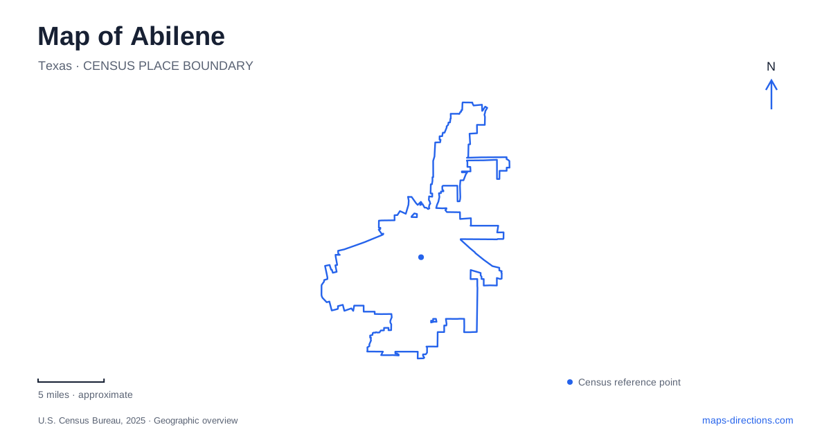
Street tiles load from OpenStreetMap when opened. The blue line shows the 2025 Census boundary.
- State
- Texas
- Population · July 2025
- 131,588
- Land area
- 106.7 sq mi
- Water area
- 5.4 sq mi
Abilene has a downtown divided by a railroad and a surrounding landscape organized by creeks, reservoirs and low hills. These features give the map more meaning than the municipal outline alone. The cultural streets near Cypress, the SoDA district south of the tracks and the recreation grounds on Zoo Lane belong to different parts of the city experience. Farther southwest, the state park introduces the Callahan Divide landscape, making a regional map useful alongside the close downtown view.
The railroad separates two downtown settings
The tourism bureau places the SoDA district immediately south of the downtown railroad tracks. Its name abbreviates South of Downtown, and its published business locations include Chestnut, Locust, Oak and South Third streets. Those references make the district legible as a particular group of blocks rather than a vague synonym for the entire center. The rail line is the clearest feature to retain when moving between the two sides on a map.
North of that divide, Cypress Street supplies a strong cultural anchor. The Grace Museum occupies the former Hotel Grace at 102 Cypress Street, bringing an older hospitality building into the present museum district. The contrast is useful: the museum gives one fixed reference on the northern side, while the SoDA street group identifies a separate cluster to the south. A downtown outing can encompass both without pretending that their names describe exactly the same area.
Cultural addresses form a compact set of references
Abilene's visitor center is listed on North First Street, and Frontier Texas also has a North First Street address. Their common road provides a practical line for reading the central cultural area. The Grace Museum adds Cypress Street to that arrangement. Rather than memorizing every attraction at once, a visitor can use these named streets to organize a small downtown map and then fill in individual venues.
The museum's reuse of a 1909 hotel is also a useful reminder that the district's present function differs from the original purpose of some buildings. An architectural landmark can remain geographically stable while its activities change. For map reading, the building and street are durable references; a particular exhibition, restaurant tenant or event is a separate layer. That distinction allows the downtown geography to remain understandable without relying on a list of businesses that may change.
Cedar Creek introduces a linear outdoor landscape
The Cedar Creek Waterway is an urban trail reference rather than another downtown commercial district. Municipal recreation material places an access area in the 100 block of East South 11th Street, and a city-organized hike used the creek bank northward toward Stevenson Park. These details explain the corridor's direction and its connection with another named recreation place. They also distinguish Cedar Creek from the separate Elm Creek landscape southwest of the city.
For someone comparing outdoor options in Abilene, that distinction is substantive. An urban creek corridor can fit a different outing from a state-park visit in the hills. The waterway's line through the city supplies continuity, while Stevenson Park supplies a recognizable destination along it. A municipal trail map is the appropriate scale for understanding the actual path; a regional road map is better suited to the longer approach toward the southwestern park landscape.
Zoo Lane gathers several recreation uses
Grover Nelson Park is listed at 2070 Zoo Lane. The city's facility directory groups the zoo with sports fields, picnic spaces, a playground, walking paths and a lake or creek setting. This combination makes Nelson a substantial recreation destination rather than a single attraction pin. A visit can focus on the zoo or on the surrounding public park, and those choices give different meanings to the same larger area on the map.
The zoo's own history explains its relocation to Grover Nelson Park following a public bond vote in the 1960s. That historical relationship helps clarify why zoo and park names appear together. They are geographically connected, but the park's broader recreation grounds are not simply another name for the zoo. Keeping both labels visible gives a more accurate picture of this destination cluster.
The southwest landscape belongs on a regional map
Abilene State Park is outside the downtown setting, southwest of the city near Buffalo Gap. Texas Parks and Wildlife describes a valley within the low limestone hills of the Callahan Divide. Elm Creek supports a more wooded environment than the surrounding uplands, while the divide separates the Brazos and Colorado watersheds. This explains the shift in landscape rather than treating the park as just another patch of municipal green space.
The park's lake, Buffalo Wallow pond and creek trails provide separate local features within that broader setting. For an Abilene overview, the useful relationship is between the railroad-centered urban core and this creek-and-hill country to the southwest. One map scale reveals the downtown blocks; another reveals the regional excursion. Reading both preserves the city's actual geography instead of suggesting that every attraction with the same city name sits within one walkable center.
Map and statistics: U.S. Census Bureau, 2025 Gazetteer, January 2025 generalized place boundaries and Vintage 2025 population estimates. Local references: Abilene Convention and Visitors Bureau; Texas Historical Commission; City of Abilene; Abilene Zoo; Texas Parks and Wildlife. Article prepared by Maps & Directions.